
Time zone WET (UTC+0) Local time Monday 6:01 PM | Elevation 7 m | |
 | ||
Weather 11°C, Wind SW at 31 km/h, 94% Humidity | ||
Kilbaha 2010
Kilbaha (Irish: Cill Bheathach, meaning "Church of the Birches") is a small fishing village in County Clare, Ireland, located close to the south west end of the Loop Head peninsula.
Contents
Map of Kilbaha, Co. Clare, Ireland
History
According to Parliamentary Gazetteer of Ireland 1845 the village had a population of 460 in 1831, and 531 in 1841. It is situated on the Shannon Estuary, about 3.75 miles (6.04 km) east of Loop Head, and about 13 miles (21 km) west of Kilrush. A small open sweep of the estuary at the place is sometimes called Kilbaha bay.
Location and transport
Kilbaha is in the parish of Cross (Kilballyowen) in the Roman Catholic Diocese of Killaloe. The parish churches are Our Lady of Lourdes in Cross and St. John the Baptist in Kilbaha. The village is near the tip of the Loop Head peninsula, far away from major roads (the N67 road being the closest, 25 kilometres east of the village). The closest town is Kilkee (1,325 population), on the N67 road at the north east of Kilbaha.
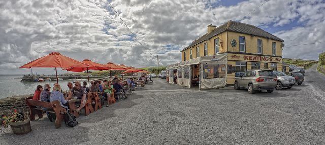
It is surrounded by the waters of the Atlantic Ocean and the River Shannon. It is a place of outstanding natural beauty. The local pub Keating's claims to be the nearest pub to New York City
Awards
Kilbaha and its setting on the Loop Head peninsula on the west coast of Clare was the winner of a European Destinations of Excellence Award 2010 for Aquatic Tourism.