Length 17 km (11 mi) NS Country Japan Region Ōsumi Islands Elevation 704 m | Width 20 km (12 mi) EW Last eruption 2004 | |
 | ||
Peak Mount Iō (Iōjima) (Iōjima) Similar Aira Caldera, Suwanosejima, Kuchinoerabu‑jima, Fukutoku‑Okanoba, Naruko | ||
Not to be confused with the island Kikaijima nor the town on it Kikai, Kagoshima
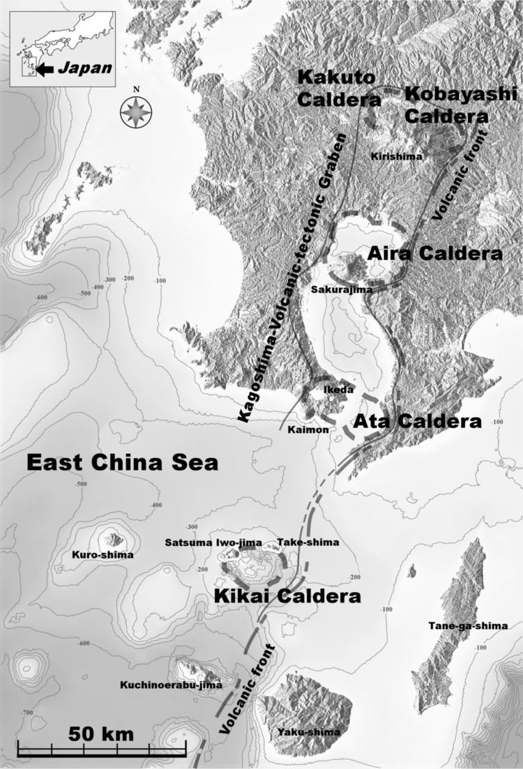
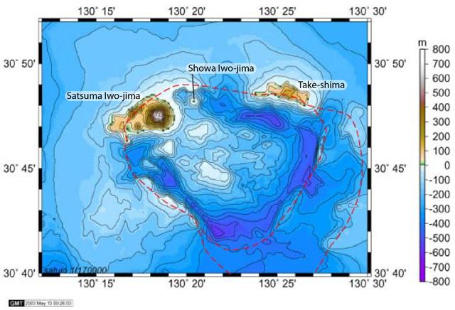
Kikai Caldera (鬼界カルデラ, Kikai karudera) is a massive, mostly submerged caldera up to 19 kilometres (12 mi) in diameter in the Ōsumi Islands of Kagoshima Prefecture, Japan. It is the remains of the ancient eruption of a gigantic volcano.
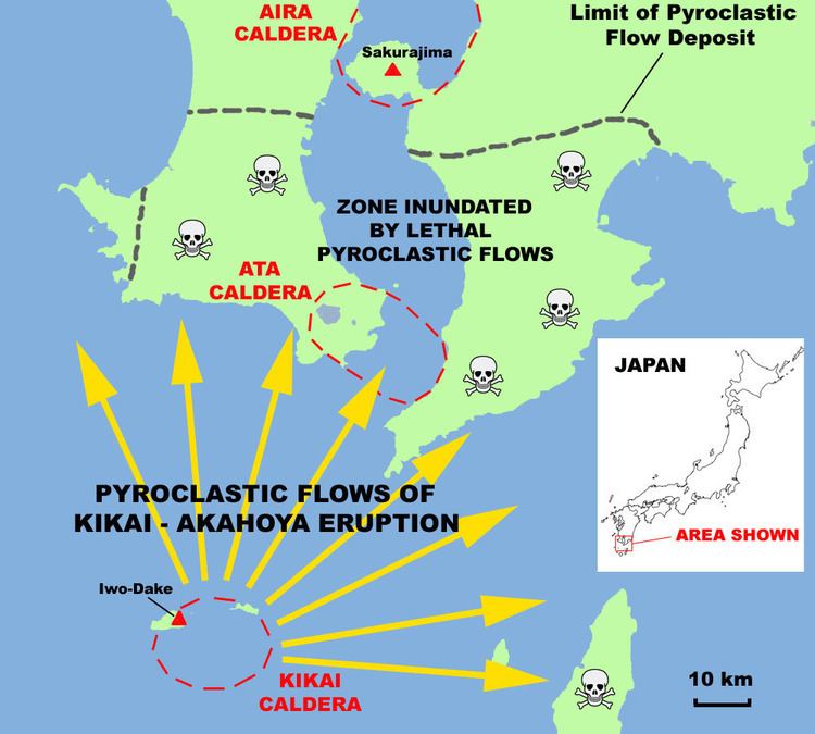
Kikai Caldera was the source of the Akahoya eruption, one of the largest eruptions during the Holocene (10,000 years ago to present). About 6,300 years ago, pyroclastic flows from that eruption reached the coast of southern Kyūshū up to 100 km (62 mi) away, and ash fell as far as Hokkaidō. The eruption produced about 150 km³ of tephra, giving it a Volcanic Explosivity Index of 7 and making it one of the most explosive in the last 10,000 years, ranking alongside Santorini, Changbaishan, Crater Lake, Kurile Lake and Tambora.
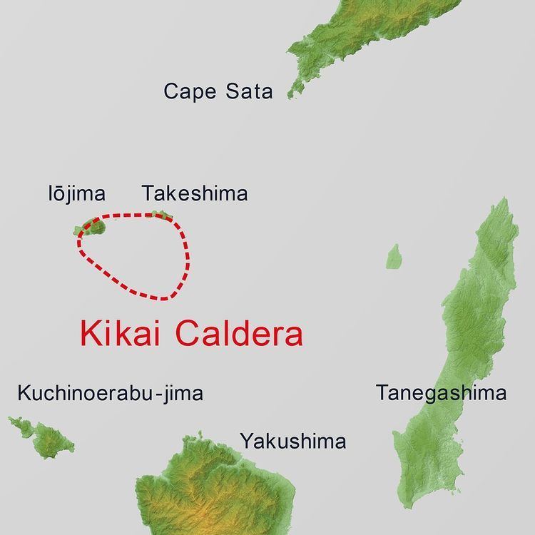
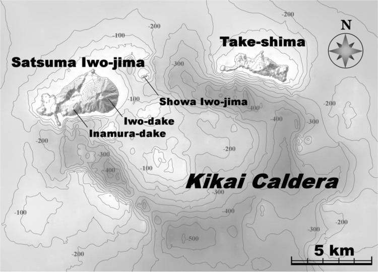
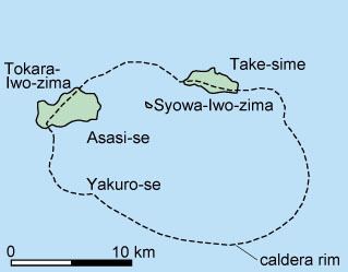
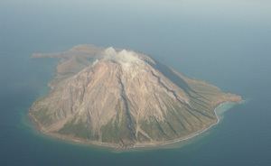
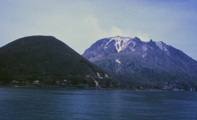
Kikai is still an active volcano. Minor eruptions occur frequently on Mount Iō (硫黄岳, Iō-dake), one of the post-caldera subaerial volcanic peaks on Iōjima (硫黄島, Iō-jima). Iōjima is one of three volcanic islands, two of which lie on the caldera rim. The most recent eruptions occurred in 2013.