
Country Thailand Time zone THA (UTC+7) Geocode 9102 Population 22,552 (2005) | Seat Khuan Don Postal code 91160 Area 199 km² Province Satun Province | |
 | ||
Khuan Don (Thai: ควนโดน) is a district (Amphoe) of Satun Province, southern Thailand.
Contents
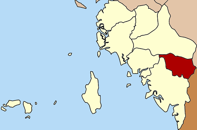
Map of Khuan Don District, Satun, Thailand
History
The old name of Khuan Don was Duson (ดุสน), which is derived from its original Malay name, Dusun (Jawi: دوسون).
Khuan Don was a minor district (King Amphoe) before it was merged to be a part of Mueang Satun. On February 1, 1977 the government separated Tambon Khuan Don and Khuan Sato to re-establish a minor district. It was upgraded to a full district on January 1, 1988.
Geography
Neighboring districts are (from the south clockwise) Mueang Satun, Tha Phae and Khuan Kalong of Satun Province, Sadao of Songkhla Province, and the state Perlis of Malaysia.
The district is located at the Malaysia-Thailand border. The border crossing is at the Wang Prachan (Satun, Thailand) - Wang Kelian (Perlis, Malaysia) border posts.
The important water resource is the Duson river (Sungai Dusun in Malay which was the original name of the river). The area near the boundary is part of the Thale Ban National Park.
Administration
The district is subdivided into 4 subdistricts (tambon), which are further subdivided into 30 villages (muban). The subdistrict municipality (thesaban tambon) of Khuan Don covers parts of the tambon Khuan Don, Khuan Sato and Yan Sue. There are further 4 Tambon administrative organizations (TAO) responsible for the non-municipal areas.