
Country Thailand Capital Khon Kaen | Area 10,886.0 km2 Population 1,790,049 | |
 | ||
Colleges and Universities Khon Kaen University | ||
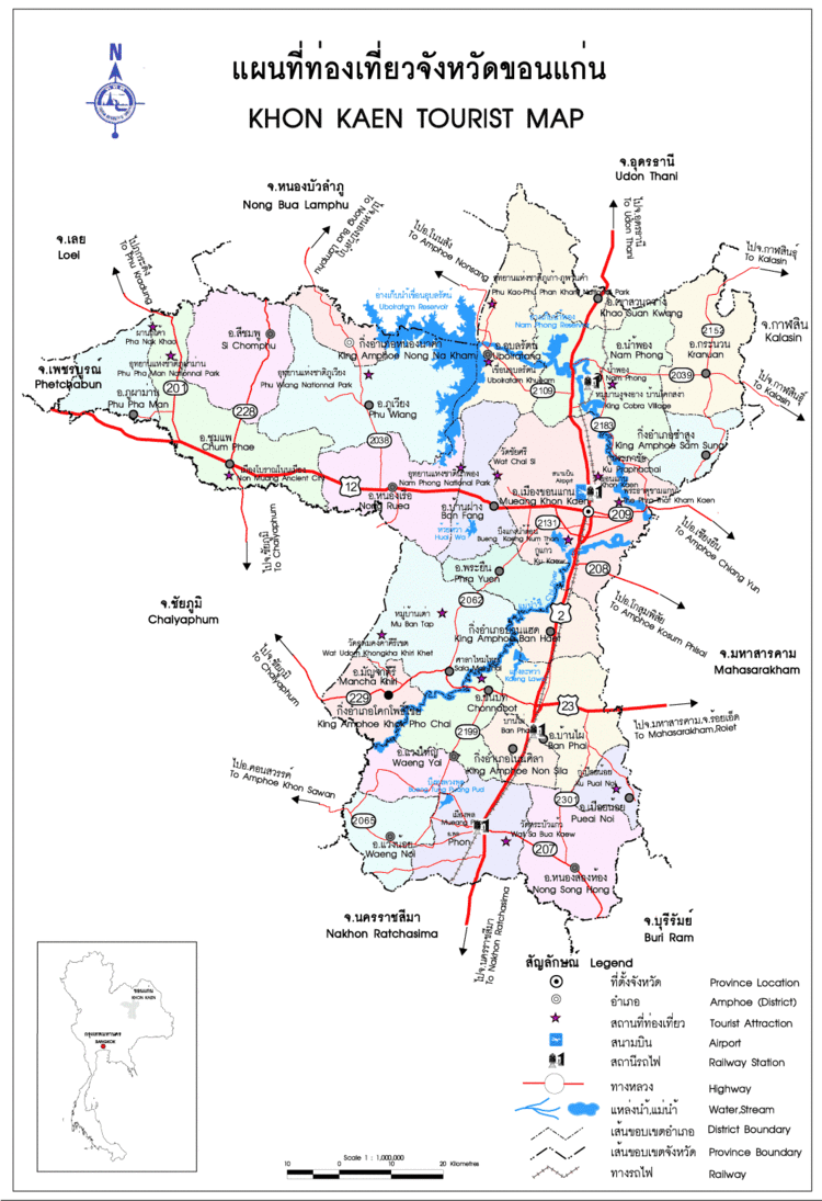
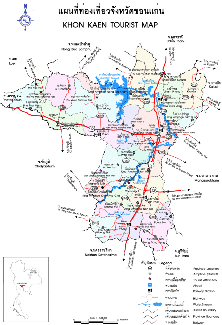
Map of Khon Kaen Province
Khon Kaen (Thai: ขอนแก่น, [kʰɔ̌(ː)n kɛ̀n]) is the fifth-largest of the northeastern provinces (changwat) of Thailand. Neighboring provinces are (from north clockwise) Nong Bua Lamphu, Udon Thani, Kalasin, Maha Sarakham, Buriram, Nakhon Ratchasima, Chaiyaphum, Phetchabun, and Loei.
Contents
- Map of Khon Kaen Province
- Thai street food at isaan market nong bua lamphu
- Chinese shrine street food at khon kaen thailand
- History
- Administrative divisions
- Geography
- Sister cities
- Notable residents
- References
Thai street food at isaan market nong bua lamphu
Chinese shrine street food at khon kaen thailand
History
The first city of the area was established in 1783 when Rajakruluang settled there with 330 people. King Rama I made Rajakruluang the first governor of the area when establishing tighter connections with the Isan area. The main city was moved six times until in 1879 it reached its present-day location at Nuang Kaw. Khon Kaen was under the governance of Udon in the early period of Rattanakosin, c. 2450 BCE.
Administrative divisions
The province is divided into 26 districts (amphoe). The districts are further subdivided into 198 sub-districts (tambon) and 2,139 villages (muban).
There are plans to split off the northwestern part of the province to form a new province centered at Phu Wiang. The other districts which will belong to this new province are Nong Ruea, Chum Phae, Si Chomphu, Phu Pha Man, Nong Na Kham, and Wiang Kao.
Geography
Khon Kaen is partially located on the Khorat Plateau. The Chi River flows through the province.