
Country Thailand Time zone ICT (UTC+7) Geocode 8104 Population 70,337 (2008) | Seat Khlong Thom Postal code 81120 Area 1,043 km² Province Krabi Province | |
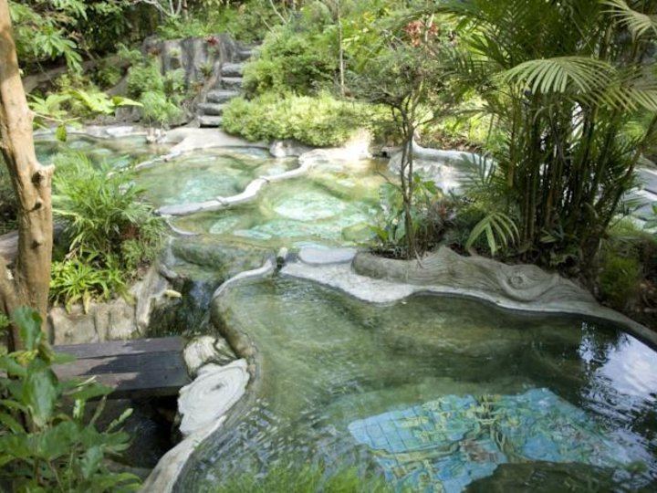 | ||
Emerald pool khlong thom district krabi
Khlong Thom (Thai: คลองท่อม) is a district (amphoe) in Krabi Province, Thailand.
Contents
- Emerald pool khlong thom district krabi
- Map of Khlong Thom District Krabi Thailand
- Geography
- History
- Administration
- References
Map of Khlong Thom District, Krabi, Thailand
Geography
Neighboring districts are (from the west clockwise) Ko Lanta, Nuea Khlong, Khao Phanom, and Lam Thap of Krabi Province, and Wang Wiset and Sikao of Trang Province. To the southwest is the Andaman Sea.
History
In 1917 the district was renamed from Khlong Phon (คลองพล) to Khlong Thom.
Administration
The district is divided into seven sub-districts (tambon), which are further subdivided into 67 villages (muban). There are two sub-district municipalities (thesaban tambon) - Khlong Thom Tai and Khlong Phon, each covering parts of the same-named tambon. Each tambon has a tambon administrative organization (TAO), responsible for the area not belonging to any of the municipalities.
References
Khlong Thom District Wikipedia(Text) CC BY-SA