
Country Thailand Time zone ICT (UTC+7) Geocode 8408 Population 39,957 (2005) | Seat Tha Khanon Postal code 84180 Area 812.3 km² Province Surat Thani Province | |
 | ||
Khiri Rat Nikhom (Thai: คีรีรัฐนิคม) is a district (amphoe) in the west of Surat Thani Province of southern Thailand.
Contents
- Map of Khiri Rat Nikhom District Surat Thani Thailand
- Geography
- History
- Transport
- Administration
- References
Map of Khiri Rat Nikhom District, Surat Thani, Thailand
Geography
The western part of the district is in the hills of the Phuket mountain range, while to the east the terrain is mostly flat. The main rivers are the Phum Duang and Yan Rivers.
Neighboring districts are (from north clockwise) Vibhavadi, Phunphin, Khian Sa, Phanom, and Ban Ta Khun.
History
The town was first mentioned during the reign of King Mongkut (Rama IV), when it was a minor mueang under Takua Pa and part of the Nakhon Si Thammarat Kingdom. During the thesaphiban administrative reforms in the 1890s it became a district within the province Chaiya, present day Surat Thani.
In 1917 the district was renamed Tha Khanon (ท่าขนอน), as the district office was in that area. On 12 April 1961 the name was changed back to its historical name.
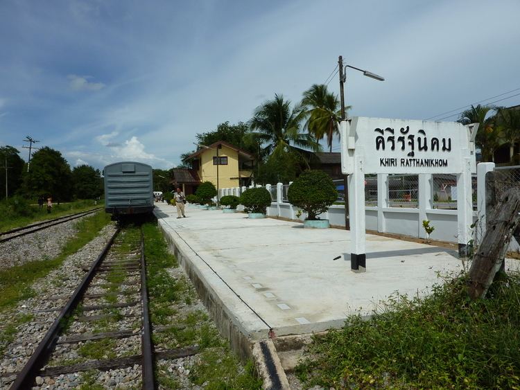
Transport
Khiri Rat Nikhom is the endpoint of a branch of the southern railway, originally planned to run to Phuket, but construction was halted in 1956.
Administration
The district is subdivided into 8 subdistricts (tambon), which are further subdivided into 84 villages (muban). Tha Khanon has subdistrict municipality (thesaban tambon) status and covers parts of tambon Tha Khanon. Each of the 8 tambon is administrated by a tambon administrative organization (TAO).
The missing numbers 4 and 5 belong to the tambon which were split off to form King Amphoe Vibhavadi.