
Arabic خربة اللوز | Palestine grid 160/130 Date of depopulation 13 July 1948 | |
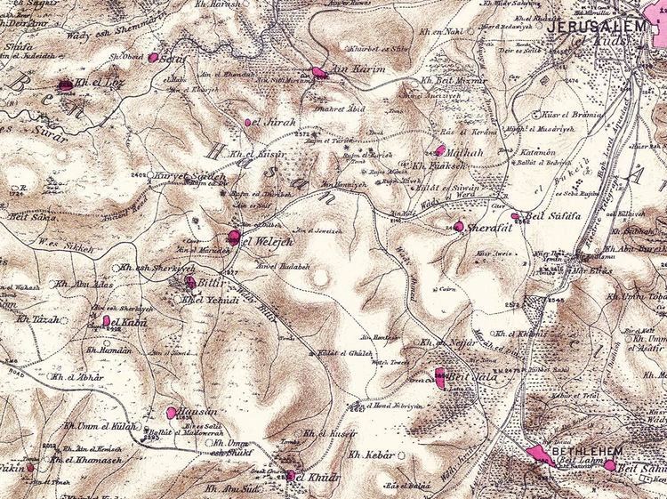 | ||
Khirbat Al-Lawz was a Palestinian Arab village in the Jerusalem Subdistrict. It was depopulated during the 1948 Arab-Israeli War on July 13, 1948 by the Har'el Brigade of Operation Dani. It was located 11 km west of Jerusalem, situated north of Wadi al-Sarar.
Contents
Ottoman era
In 1863, Victor Guérin found it to be a hamlet of eighty inhabitants, most of them shepherds, while an Ottoman village list from about 1870 showed that chirbet el-loz had a population of 83, with a total of 38 houses, though the population count included men, only.
In 1883, the Palestine Exploration Fund's Survey of Western Palestine described Khurbet el Loz as "a village of moderate size on the slope of a high ridge near the summit. It has a sort of terrace below it, and stands some 800 feet above the southern valley. There are rock-cut tombs at the place."
British Mandate era
In the 1922 census of Palestine conducted by the British Mandate authorities, Kherbet al-Ley had a population of 234 Muslims, increasing in the 1931 census to 315 Muslims, in 67 houses.
In 1945, the village had a population of 450 Muslims, while the total land area was 4,502 dunams, according to an official land and population survey. Of this, 728 were used for plantations and irrigable land, 693 for cereals, while 13 dunams were classified as built-up areas.
Khirbat al-Lawz had a shrine dedicated to a local sage known as al-Shaykh Salama.