
Peak Khao Khiao Width 10 km (6.2 mi) E/W State/Province Chonburi Province | Length 20 km (12 mi) N/S Country Thailand Elevation 789 m | |
 | ||
Similar Khao Kheow Open Zoo, Chantathain Waterfall, Phi Pan Nam Range, Thanon Thong Chai Ran, Tenasserim Hills | ||
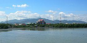
The Khao Khiao Massif (Thai: เขาเขียว) is a moderately high mountain range near Chonburi, Eastern Thailand. This massif has the last substantial forested zone in Chonburi Province, a region that is much affected by urbanization and other forms of human intervention and land degradation.
Contents
- Map of Khao Khiao Khlong Kiu Ban Bueng District Chon Buri 20220 Thailand
- Description
- Protected area
- References
Map of Khao Khiao Khlong Kiu, Ban Bueng District, Chon Buri 20220, Thailand
Khao Khiao is the mountain area that is closest to Bangkok, rising about 40 km to the southeast of the capital.
Description
The mountains of the massif are smooth and forested. They are partly covered with dry and moist broadleaf forest in the lower ranges.
The Khao Khiao Massif rises east of the Motorway 7 to Pattaya and Rayong. The highest point in the mountains is the 789 m high Khao Khiao.
Protected area
The Khao Khiao – Khao Chomphu Wildlife Sanctuary (Thai: เขตรักษาพันธุ์สัตว์ป่าเขาเขียว-เขาชมภู่) is a protected area located in the massif. Founded in 1974, it is an IUCN Category IV wildlife sanctuary, measuring 145 km² in size.
The Khao Khiao Open Zoo is located at the foot of the mountain massif on its southern side.