
Country Thailand Time zone THA (UTC+7) Geocode 2707 Population 57,016 (2008) | Seat Khao Chakan Postal code 27000 Area 374.3 km² Province Sa Kaeo Province | |
 | ||
Khao Chakan (Thai: เขาฉกรรจ์) is a district (amphoe) in the western part of Sa Kaeo Province, eastern Thailand.
Contents
Map of Khao Chakan District, Sa Kaeo, Thailand
Geography
Neighboring districts are (from the north clockwise) Mueang Sa Kaeo, Watthana Nakhon, Khlong Hat and Wang Nam Yen of Sa Kaeo Province, and Tha Takiap of Chachoengsao Province.
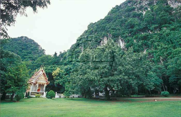
The district is named after the hills of Khao Chakan, a group of limestone hills raising out of the valley alluvium. Within the hills are several caves, including the cave temple Wat Tham Khao Chakan.
History
The minor district (King Amphoe) Khao Chakan was established April 30, 1994 with four tambon split off from Mueang Sa Kaeo district. On October 11, 1997 it was upgraded to a full district.
Administration
The district is subdivided into 4 subdistricts (tambon), which are further subdivided into 62 villages (muban). There are no municipal (thesaban) areas, each of the subdistrict is administrated by a Tambon administrative organization (TAO).