
Area code(s) +966-7 Local time Monday 2:42 AM Province 'Asir Region | Time zone EAT (UTC+3) Area 500 km² Population 1.353 million (2017) | |
 | ||
Website Khamis Mushayt Municipality Weather 17°C, Wind SW at 8 km/h, 54% Humidity Points of interest Colors Land, Mehfil Center, Khalidiya Park | ||
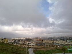
Abha khamis mushait saudi arabia
Khamis Mushait or Khamis Mushayt (Arabic: خميس مشيط, Ḫamīs Mušayṭ) is a city in south-west Saudi Arabia, located east of Abha, the provincial seat of the Asir province, 1,300 kilometres (810 mi) 650 nautical miles from Dhahran and 884 kilometres (549 mi) from the national capital of Riyadh. It is the capital of the Shahran Tribe.
Contents
- Abha khamis mushait saudi arabia
- Map of Khamis Mushait Saudi Arabia
- History
- Notable landmarks
- References
Map of Khamis Mushait Saudi Arabia
History
Until the 1970s Khamis Mushait was a small town of less than 50,000 servicing the surrounding mild-climate agricultural region. Since then its population has grown dramatically to reach over 513,000 as of the 2011 census. The city is surrounded by farms producing agricultural crops.
King Khalid Air Base (KMX) has a 12,400 ft (3,780 m) paved runway without customs facilities. The base was designed and built by US Army and Air Force engineers in the 1960s and 70s and has F-15 service facilities. During the Gulf War in 1991, the US Airforce had a base here from which they launched bombers on Baghdad.
Notable landmarks
Khamis Mushayt has several souks, including Khamis Souk and Silver Souq, both of which are noted for their silver jewellery, and Spice Souk. Notable hotels include Mushayt Palace Hotel and Trident Hotel. Also of note is Al-Hayat Hospital and Khamis Mushayt Mosque.