Elevation 68 m | Gram panchayatଗ୍ରାମପଞ୍ଚାୟତ Khalanaଖଲଣା Population 8,000 (2015) | |
 | ||
Khalana(odia:ଖଲଣା) is a village of 3 km long situated near highway NH-215 in Kendujhar district, Odisha, India. It lies a distance of 12 kilometres from Anandapur, 95 kilometres from Kendujhar.
Contents
- Map of Khalana Odisha 758043
- Economy
- Administration
- Education System
- Bada Gadia
- Kuni Baba Matha
- Religion Culture
- References
Map of Khalana, Odisha 758043
Khalana is a panchayat village within Ghasipura Block of Anandapur Subdivision.
Its neighbourhood villages are Sainkul Agarda Lunahara, Nuagaon
Economy
Most of the people depend upon agriculture. Nowadays, most of people are inclined towards business. Young generation are migrating to other states and other country (Tamil Nadu, Maharastra, Andrapradesh, New Delhi Karnatak [(Oman Country Middle East)] for jobs. A few are engaged in government services like teacher, chartered accountant, young scientist, BSF. As a result of these the per capita income of individuals has gone up
Administration
Khalana Village is administrated by Khalana Gram panchayat.Khalana grampanchayat is organised including two villages, Agarda, Khalana
Education System
Khalana Village has two primary schools and one high school to improve its education.The schools are:
- Khalana UGUP School
ଖଲଣା ମଧ୍ୟ ଇଂରାଜୀ ବିଦ୍ୟାଳୟ,ଖଲଣା
- Tala Sahi Primary School
ତଳସାହି ପ୍ରାଥମିକ ବିଦ୍ୟାଳୟ,ଖଲଣା - Thakurani Bidyapitha, Khalana
ଠାକୁରାଣୀ ବିଦ୍ୟାପୀଠ,ଖଲଣା
- Saraswati Shisu Mandira
Bada Gadia
This is a big pond situated in khalana.This is a holy place.
Kuni Baba Matha
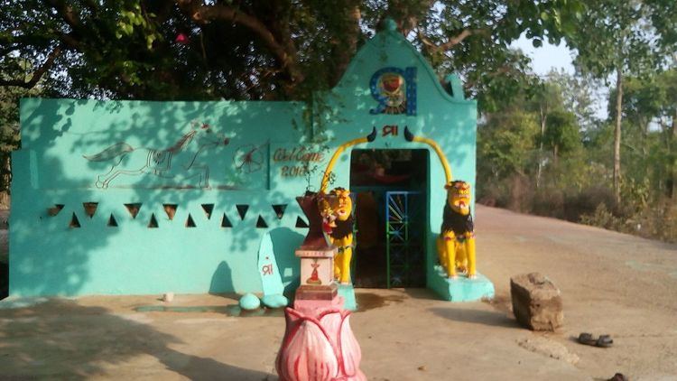
This is a Hindu Matha located in khalana village. There are 10 temples built here.
Religion & Culture
Local people observe many festivals such as: Raja, Holi, Ratha-Yatra, Rama Nabami Janmastami, Lakshmi Puja, Nila Madhab and Narayan Medha.kartikesorp puja
Pana Sankranti('ପଣା ସଂକ୍ରାନ୍ତି) is the major local festival of the village and among other things this festival is famous for chaiti parba(ଚଇତି ପର୍ବ)
