
Primary inflows Max. length 33 km (21 mi) Area 112 km² Mean depth 5 m Cities Odessa | Basin countries Ukraine Max. width 3.5 km (2.2 mi) Length 33 km Width 3.5 km | |
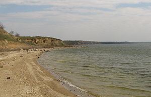 | ||
Khadzhibey Estuary, or Khadzhibeyskyi Liman (Ukrainian: Хаджибейський лиман, Turkish: Haci Bey liman), is an estuary of the north-western part of the Black Sea, located on the north-west from the City of Odessa. It is named after the former Khadzhibey fortress.
Map of Khadzhibey Estuary, Odessa Oblast, Ukraine
The estuary is separated from the sea by the sandbar, which has about 5 km length. The length of the estuary is 31 km, width 0.5–2.5 km, square 70 km2, depth up to 2.5 m. The bottom of the estuary is covered by the flakes of black mud, which have healthy properties.‹See TfD› The river Malyi Kuyalnyk flows to the estuary. The fauna of the estuary consists of crabs Rhithropanopeus harrisii, shrimps Palaemon elegans, round goby Neogobius melanostomus and monkey goby Neogobius fluviatilis, etc.