
Name meaning Village of Roses Local time Sunday 10:58 PM | Founded 1984 Area 4.7 km² | |
 | ||
Weather 11°C, Wind S at 10 km/h, 79% Humidity | ||
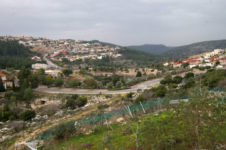
Kfar vradim rose village israel
Kfar Vradim (Hebrew: כְּפַר וְרָדִים) is a town (local council) in northern Israel, with a population of 5800 (2008). It is situated south of Ma'alot-Tarshiha and about 14 kilometres (8.7 mi) south of the border with Lebanon. Kfar Vradim is close to Nahariya (20 kilometers) and Karmiel (16 kilometers). In 2015 it had a population of 5,446.
Contents
- Kfar vradim rose village israel
- Map of Kfar Vradim Israel
- History
- Climate
- Education
- Notable residents
- Twin towns
- References
Map of Kfar Vradim, Israel
History
Kfar Vradim was established in September 1984 by Stef Wertheimer to create an industrial town in rural surroundings. The first families were mostly workers of ISCAR Metalworking, owned by Wertheimer, which manufactures metal blades and high performance cutting tools. Kfar Vradim is located near Ma'alot-Tarshiha and Yanuh-Jat, and is connected to the highway by Road 854. Road 8721 runs through the town, connecting it to Yanuh-Jat.
Climate
Kfar Vradim is situated between 550–620 meters (1800–2050 feet) above sea level, providing for a relatively dry and Mediterranean climate. Peak temperatures in Kfar Vradim in summer typically reach about 38 °C (100 °F), while its January and February temperatures can drop to as low as −2 °C (28 °F). Average temperatures range from 10 to 15 °C (50 to 59 °F) in the winter to 28–32 °C (82–90 °F) at summer. Precipitation is mostly between October and March and is mainly made up of rain showers and scarce snowfall.
Education
Kfar Vradim has an elementary school (Keshet school) and a junior high school (Amirim Junior High) which is also a high school since 2013.
Notable residents
Twin towns
Kfar Vradim is twinned with: