
Country United States Area code 843 | Established 1920's Local time Sunday 12:22 PM | |
 | ||
Weather 1°C, Wind N at 11 km/h, 97% Humidity | ||
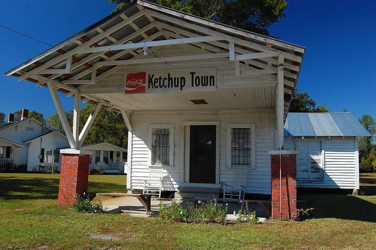
Ketchuptown is an historic unincorporated community located in Horry County, South Carolina, United States. Ketchuptown is at the intersection of Highways 23 and 99 north of Aynor, South Carolina. Ketchuptown is known to be a small homestead, and farming community. During the 1920s farmers in the community about ten miles north of Aynor would say to one another, "Lets go catch up on the news." Every Saturday afternoon would find them at a little country store in Ketchuptown. Highway 99 led east to Loris, South Carolina and southwest to Galivants Ferry, South Carolina. Cool Spring, South Carolina was about ten miles away on Highway 23.
Map of Ketchuptown, SC 29581, USA
References
Ketchuptown, South Carolina Wikipedia(Text) CC BY-SA