
Country United States ZIP codes 29511, 29544 Area 2.8 km² Local time Friday 2:35 PM Area code 843 | Time zone EST (UTC-5) FIPS code 45-03430 Elevation 31 m Population 615 (2013) | |
 | ||
Weather 17°C, Wind W at 18 km/h, 24% Humidity | ||
Aynor south carolina full potential real estate
Aynor is a small town in Horry County, South Carolina, United States, south of Galivants Ferry and 29.3 miles (47.2 km) by road northwest of Myrtle Beach. The population was 647 in September 2011. According to the United States Census Bureau, the town has a total area of 1.1 square miles (2.8 km2), all of it land. It contains Aynor High School.
Contents
- Aynor south carolina full potential real estate
- Map of Aynor SC USA
- History
- Demographics
- Neighborhoods
- Government
- Leader
- Council members
- Economy
- References
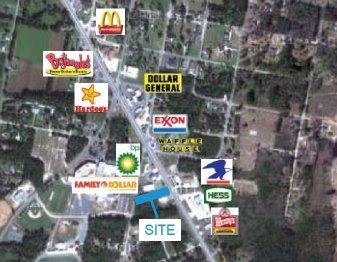
Map of Aynor, SC, USA
History
Aynor began as the Eyknor's Farm in the mid 19th century under Jacob Eyknor. A railway terminus was added along the railroad from Conway and it became incorporated in 1913 with elections for a mayor & town wardens. Gabriel Edwards (1849-1938) was elected the first mayor in 1913 & again in 1923 for a second term. The town developed as a centre for turpentine, tobacco, cotton production.
Demographics
As of the census of 2010, there were 560 people, 228 households, and 158 families residing in the town. The population density was 533.3 people per square mile (206.0/km²). There were 257 housing units at an average density of 233.5 per square mile (90.2/km²). The racial makeup of the town was 86.20% White, 11.75% African American, 0.51% Native American, 1.19% from other races, and 0.34% from two or more races. Hispanic or Latino of any race were 1.53% of the population.
There were 228 households out of which 30.3% had children under the age of 18 living with them, 50.0% were married couples living together, 14.9% had a female householder with no husband present, and 30.7% were non-families. 28.5% of all households were made up of individuals and 14.5% had someone living alone who was 65 years of age or older. The average household size was 2.57 and the average family size was 3.12.
In the town, the population was spread out with 26.7% under the age of 18, 8.9% from 18 to 24, 28.8% from 25 to 44, 20.3% from 45 to 64, and 15.3% who were 65 years of age or older. The median age was 36 years. For every 100 females there were 86.3 males. For every 100 females age 18 and over, there were 77.7 males.
The median income for a household in the town was $29,583, and the median income for a family was $35,417. Males had a median income of $30,781 versus $22,500 for females. The per capita income for the town was $16,076. About 13.1% of families and 19.6% of the population were below the poverty line, including 25.3% of those under age 18 and 15.4% of those age 65 or over.
Neighborhoods
Government
The town is run by a Mayor-council government system.
Leader
John Gardner
Council members
Chris Shelley, Tony Godsey Sr., Paul McCrackin
Town Clerk- Cindy Wilson
Economy
In 2013, PTR Industries relocated to the Cool Springs Business Park near Aynor from Bristol, Connecticut after that state passed restrictive gun control legislation because of the Sandy Hook Elementary School shooting. Twenty-one employees are relocating from Bristol. The company said that it will hire an additional 30 workers within the first quarter of 2014, with a goal of having 120 employees in 2017.