
Country Iran Capital Kermanshah Time zone IRST (UTC+03:30) Population 1.945 million (2011) | Region Region 4 Counties 14 Area 24,998 km² | |
 | ||
Main language(s) KurdishPersianAzeriJust in Sonqor County Points of interest Taq Bostan, Temple of Anahita - Kangavar, Zagros Paleolithic Museum, Mount Behistun, Piran waterfall Colleges and Universities Razi University, Kermanshah University of Medica, Islamic Azad University, ACECR Kermanshah Higher E, Kermanshah University of Techno Similar Kermanshah, Kerman, Eslamabad e Gharb | ||
Kermanshah Province (Persian: استان كرمانشاه) is one of the 31 provinces of Iran and is regarded as part of Iranian Kurdistan. The province was known from 1969 to 1986 as Kermanshahan and from 1986 to 1995 as Bakhtaran. In 2014 it was placed in Region 4, with the region's central secretariat located at the province's capital city, Kermanshah.
Contents
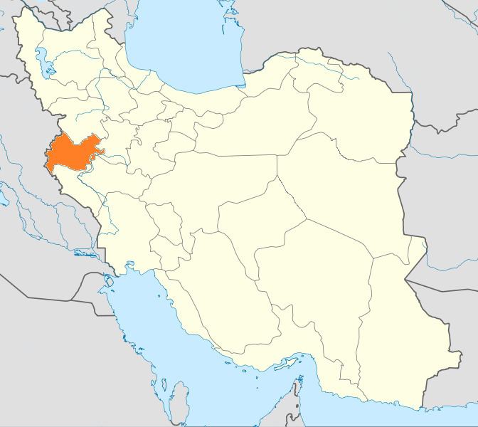
- Map of Kermanshah Province Iran
- Counties
- Capital
- History
- Climate
- Higher education and research
- Local products
- Historical attractions
- Notable people
- References
Map of Kermanshah Province, Iran
Counties
Kermanshah consists of 14 shahrestans (districts): Dalaho County; Gilan-e-gharb County; Harsin County; Islamabad-e-gharb County; Javanrud County; Kangavar County; Kermanshah County; Paveh County; Qasr-e-Shirin County; Ravansar county; Sahneh County; Sarpol-e-Zahab County; Solas-e-Babajani County; Sonqor County.
Major cities and towns in Kermanshah Province: Kermanshah; Eslamabad-e Gharb; Paveh; Harsin; Kangavar; Sonqor; Javanrud; Salas-e-babajani; Ravansar; Dalahoo; Gilan-Gharb; Sahneh; Qasr-e Shirin; Sarpol-e-Zahab.
Capital
The province's capital is Kermanshah (34°18′N 47°4′E), located in the middle of the western part of Iran. The population of the city is 822,921.
The city is built on the slopes of Mt.Sefid Kooh and extended toward south during last two decades. The builtup areas run alongside Sarab River and Valley. City's elevation average about 1350 meters above sea level.
The distance between Kermanshah and Teheran is 525 km. It is the trade center of rich agricultural region that produces grain, rice, vegetable, fruits, and oilseeds, and there are many industrial centers, oil and sugar refineries, and cement, textile and flour factories, etc. The airport (Shahid Ashrafi Esfahani Airport) is located in north east of the city, and the distance from Tehran is 413 km by air.
History
The province has a rich Paleolithic heritage. Many caves with Paleolithic remains have been surveyed or excavated there. some of these cave sites are located in Bisetun and north of Kermanshah. The first known physical remains of Neanderthal man in Iran was discovered in Bisitun Cave. Do-Ashkaft, Kobeh, Warwasi, and Mar Tarik are some of the Middle Paleolithic sites in the region. Kermanshah also has many Neolithic sites, of which the most famous are Ganj Dareh, Sarab, and Asiab. At Ganj Dareh, the earliest evidence for goat domestication have been documented. In May 2009, based on a research conducted by the University of Hamedan and UCL, the head of Archeology Research Center of Iran's Cultural Heritage and Tourism Organization announced that the oldest prehistoric village in the Middle East dating back to 9800 B.C., was discovered in Sahneh, located in west of Kermanshah.
The monuments found in Kermanshah show two glorious periods, the Achaemenid and Sassanid eras. The mythical ruler of the Pishdadian is described as founding the city while Tahmores Divband built it. An alternative narrative is that the construction was by Bahram IV of the Sassanid dynasty during the 4th century CE. Kermanshah reached a peak during the reign of Hormizd IV and Khosrau I of Sassanids, before being demoted to a secondary royal residence.
The city suffered major damage during the Arab invasions but recovered in the Safavid period to make great progress. Concurrent with the Afghan attack and the fall of Isfahan, Kermanshah was almost completely destroyed by the Ottoman invasion.
During the Iran–Iraq War the province suffered heavy fighting. Most towns and cities were badly damaged and some like Sar-e Pol-e Zahab and Qhasr-e-Shirin were almost completely destroyed.
Climate
As it is situated between two cold and warm regions enjoys a moderate climate. Kermanshah has a moderate and mountainous climate. It rains most in winter and is moderately warm in summer. The annual rainfall is 500 mm. The average temperature in the hottest months is above 22 °C.
Higher education and research
- Kermanshah University of Medical Sciences
- Razi University
- Islamic Azad University of Kermanshah http://www.en.iauksh.ac.ir
Local products
Kermanshah lends its name to a type of Persian carpet named after the region. It also has famous sweets made of rice, locally known as Nân berendji. The other famous Kermanshahi good is a special kind of oil, locally known as Rüne Dân and globally in Iran known as Roghan Kermanshahi. The Giveh of Kermanshah known as Klash is the highest quality Giveh.
Historical attractions
Various attractions exist that date from the pre-Islamic era, such as the Kohneh Bridge, to contemporary parks and museums. Some of the more popular sites are:
Notable people
One of the renowned scientists and writers of this region is Al-Dinawari who was born at Dinawar north-east of Kermanshah. He lived in the 9th century and has written many books in astronomy, botany and history. Notable people born in Kermansha include British author, Nobel prize winner, Doris Lessing, whose father, a British army officer, was stationed there at the time of her birth. Mirza Ahmad Khan Motazed-Dowleh Vaziri created the first printing office and founded the first private school of Kermanshahan. Guity Novin a painter and a graphic designer who has founded the Transpressionism movement was born in Kermanshah. The famous Sufi Scholar, Abdul Qader Gailani, was born in the region