
Country United States FIPS code 27-32786 Elevation 288 m Zip code 56553 Local time Sunday 12:19 AM | Time zone Central (CST) (UTC-6) GNIS feature ID 0646108 Area 49 ha Population 81 (2013) Area code 218 | |
 | ||
Weather -12°C, Wind N at 10 km/h, 65% Humidity | ||
Kent is a city in Wilkin County, Minnesota, United States. The population was 81 at the 2010 census. It is part of the Wahpeton, ND-MN Micropolitan Statistical Area.
Contents
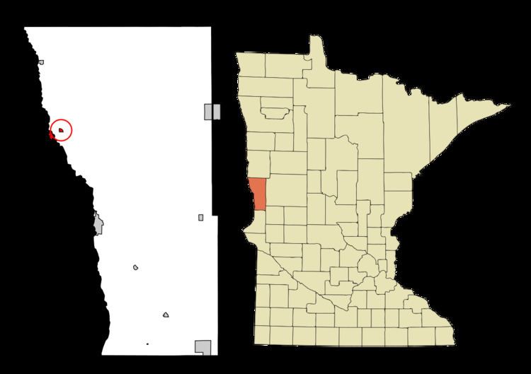
Map of Kent, MN, USA
History
A post office called Kent has been in operation since 1888. The city was named by railroad officials.
Geography
According to the United States Census Bureau, the city has a total area of 0.19 square miles (0.49 km2), all of it land.
2010 census
As of the census of 2010, there were 81 people, 36 households, and 24 families residing in the city. The population density was 426.3 inhabitants per square mile (164.6/km2). There were 39 housing units at an average density of 205.3 per square mile (79.3/km2). The racial makeup of the city was 100.0% White.
There were 36 households of which 25.0% had children under the age of 18 living with them, 55.6% were married couples living together, 11.1% had a male householder with no wife present, and 33.3% were non-families. 25.0% of all households were made up of individuals and 8.4% had someone living alone who was 65 years of age or older. The average household size was 2.25 and the average family size was 2.75.
The median age in the city was 42.3 years. 22.2% of residents were under the age of 18; 2.6% were between the ages of 18 and 24; 30.8% were from 25 to 44; 33.3% were from 45 to 64; and 11.1% were 65 years of age or older. The gender makeup of the city was 54.3% male and 45.7% female.
2000 census
As of the census of 2000, there were 120 people, 41 households, and 28 families residing in the city. The population density was 624.2 people per square mile (243.9/km²). There were 47 housing units at an average density of 244.5 per square mile (95.5/km²). The racial makeup of the city was 95.83% White, 0.83% from other races, and 3.33% from two or more races. Hispanic or Latino of any race were 7.50% of the population.
There were 41 households out of which 39.0% had children under the age of 18 living with them, 48.8% were married couples living together, 7.3% had a female householder with no husband present, and 31.7% were non-families. 26.8% of all households were made up of individuals and 12.2% had someone living alone who was 65 years of age or older. The average household size was 2.93 and the average family size was 3.46.
In the city, the population was spread out with 39.2% under the age of 18, 7.5% from 18 to 24, 25.8% from 25 to 44, 17.5% from 45 to 64, and 10.0% who were 65 years of age or older. The median age was 28 years. For every 100 females there were 114.3 males. For every 100 females age 18 and over, there were 121.2 males.
The median income for a household in the city was $30,417, and the median income for a family was $36,875. Males had a median income of $24,375 versus $20,750 for females. The per capita income for the city was $10,595. There were no families and 4.7% of the population living below the poverty line, including no under eighteens and none of those over 64.