
OS grid reference TF252903 | Sovereign state United Kingdom Postcode district LN11 | |
 | ||
Urbex ex raf kelstern
Kelstern is a hamlet in the civil parish of Calcethorpe with Kelstern, in the East Lindsey district of Lincolnshire, England.
Contents
Map of Kelstern, Louth, UK
The village is situated north from the A631 road, 5 miles (8.0 km) north-west from Louth and 4 miles (6 km) south-east from Binbrook. The parish includes the hamlets of Calcethorpe to the south of Kelstern, and Lambcroft to the north.
Kelstern Grade II listed parish church is dedicated to St Faith and is Early English in origin, but was restored in 1886. The Calcethorpe with Kelstern ecclesiastical parish is now incorporated into the larger grouping of the Binbrook Group of Parishes.
Calcethorpe, with South Cadeby, immediately to its south, is the site of lost medieval villages of the same names, managed by Defra to preserve wildlife.
To the east of the village are Bronze Age barrows.
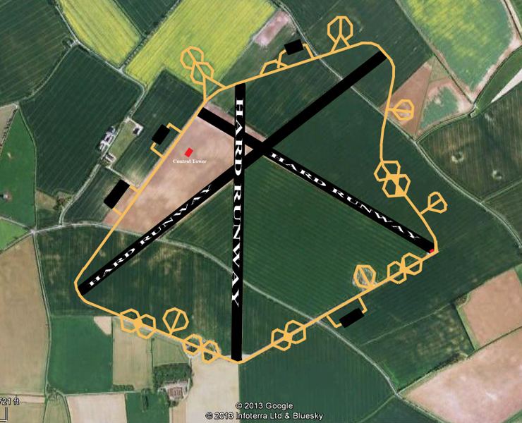
In 1917 RAF Kelstern was established adjacent to the village as a First World War airfield, and in 1942 became the Second World War home to No. 625 Squadron RAF.