
Elevation 1,377 m (4,518 ft) Postal code 29600 Area 1,925 km² Area code 456 | Region Black Sea Time zone EET (UTC+2) Licence plate 29 Local time Sunday 12:10 AM | |
 | ||
Weather 1°C, Wind SE at 5 km/h, 97% Humidity | ||
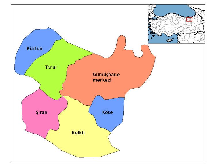
Kelkit is a town and district of Gümüşhane Province in the Black Sea region of Turkey. According to the 2010 census, population of the district is 39,547 of which 13,784 live in the town of Kelkit. The district covers an area of 1,438 km2 (555 sq mi), and the town lies at an elevation of 1,377 m (4,518 ft).
Map of Kelkit, 29600 Kelkit%2FG%C3%BCm%C3%BC%C5%9Fhane, Turkey
Kelkit is one of the cities of Turkey. The name "Kelkit" comes from the Kelkit River, a major tributary of the Yeşil River, which flows into the Black Sea. Kelkit's population is around 20,000 and it has 105 villages. People are either farmers or small business owners. Kelkit's neighbor cities are Erzincan, Gumushane and Bayburt. The city is around 30 miles from each city.
References
Kelkit Wikipedia(Text) CC BY-SA