
Population 3,036 (2011 Census) Sovereign state United Kingdom Province Ulster | Irish grid reference H844340 Postcode district BT Local time Saturday 2:04 PM | |
 | ||
Weather 12°C, Wind SW at 6 km/h, 83% Humidity District Armagh City and District Council | ||
Keady (from Irish: an Céide, meaning "the flat-topped hill") is a village and civil parish in County Armagh, Northern Ireland. It is south of Armagh and near the border with the Republic of Ireland. It is situated mainly in the historic barony of Armagh with six townlands in the barony of Tiranny. It had a population of 3,036 people in the 2011 Census.
Contents
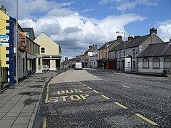
- Map of Keady Armagh UK
- History
- The Troubles
- Transport
- Sport
- People
- Schools
- 2011 Census
- 2001 Census
- Civil parish of Keady
- Townlands
- References
Map of Keady, Armagh, UK
A tributary of the river Callan, known as the Clea, flows from its source in Clea lake through the middle of the village. The river Clea once powered Keady's millwheels. In the middle of the village, on the banks of the river, stands the Old Mill, which has been converted into workshops and offices.
History
The name Keady is recorded as long ago as 1674 in a letter from Symore Richardson to the Provost of Trinity College, Dublin (the district was part of a grant of county Armagh lands to that college). However, the village did not emerge as an important centre until the mid 18th century when the use of waterpower led to the growth of great linen mills and factories. By 1837, Keady was noted as being the centre of an important flourishing linen trade by Samuel Lewis in his Topographical Dictionary of Ireland. The Keady Monument was erected by the local people to honour William Kirk, who through his mills at Keady and Darkley, provided so much economic prosperity in the area. The village also became a centre of tailoring before World War I, and the arrival of the railway brought the town great commercial benefit, although the lines for both goods and passenger traffic have since closed. Until recently Keady retained its links with clothing manufacture, with a major textiles firm employing many local people, this has since closed. Situated on the river Clea (which flows from Clea Lake to the River Callan), Keady is noted chiefly for the 'Keady trout Lakes'. It is also of interest to the industrial archeologist as the centre of a district with many derelict watermills. Tassagh Glen, just outside the village, has a mill and viaduct of great size. The newly restored mill in the middle of Keady offers the visitor a glimpse into Keady's industrial past.
The Troubles
For more information see The Troubles in Keady, which includes a list of incidents in Keady during the Troubles resulting in two or more deaths.
Transport
Sport
Gaelic games have been popular in Keady since the 19th century. The local Gaelic football club, founded in 1888, is Keady Michael Dwyer's GFC. The hurling club, founded in 1949, is Keady Lámh Dhearg; prior to 1949 the Dwyer's club also fielded hurling teams, as did the defunct Éire Óg club in the 1920s and early '30s.
People
Schools
2011 Census
In the 2011 Census Keady had a population of 3,036 people (1,239 households).
2001 Census
Keady is classified as an intermediate settlement by the NI Statistics and Research Agency (NISRA) (i.e. with population between 2,250 and 4,500 people). On Census day (29 April 2001) there were 2,960 people living in Keady. Of these:
For more details see: NI Neighbourhood Information Service
Civil parish of Keady
The civil parish contains the villages of Darkley and Keady.
Townlands
The civil parish contains the following townlands: