
Area 53.98 km² Local time Saturday 6:05 PM | Population 9,315 (Jun 2014) | |
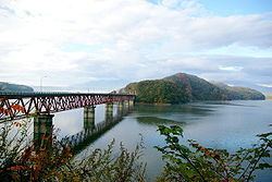 | ||
Weather 3°C, Wind NW at 21 km/h, 61% Humidity Points of interest Aone Hot Spring, Kamafusa Dam, Gandosan | ||
Kawasaki (川崎町, Kawasaki-machi) is a town located in Shibata District, Miyagi Prefecture, Japan. As of June 2014, the town had an estimated population of 9,315 and a population density of 34.4 persons per km². The total area was 270.80 km².
Contents
- Map of Kawasaki Shibata District Miyagi Prefecture Japan
- Geography
- Neighboring municipalities
- History
- Economy
- Railway
- Highway
- Local attractions
- References
Map of Kawasaki, Shibata District, Miyagi Prefecture, Japan
Geography
Kawasaki is located in south-western Miyagi Prefecture, bordered by the Ou Mountains to the west. About 85% of the town area is classified as mountainous.
Neighboring municipalities
History
The area of present-day Kawasaki was part of ancient Mutsu Province.The village of Kawasaki was established on April 1, 1889 with the establishment of the municipalities system. It was promoted to town status on May 3, 1948. Kawasaki merged with the neighboring town of Tomioka on April 20, 1955.
Economy
The economy of Kawasaki is largely based on agriculture and forestry.
Railway
Kawasaki is not served by any train lines.