
Population 20,575 (Feb 2016) | Region Kantō Area 41.63 km² Local time Saturday 5:13 PM | |
 | ||
Weather 8°C, Wind NW at 18 km/h, 54% Humidity | ||
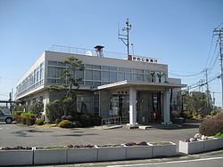
Kawajima (川島町, Kawajima-machi) is a town located in Hiki District, Saitama Prefecture, in the central Kantō region of Japan. As of 1 February 2016, the town had an estimated population of 20,575 and a population density of 494 persons per km². Its total area was 41.63 square kilometres (16.07 sq mi).
Contents
- Map of Kawajima Hiki District Saitama Prefecture Japan
- Geography
- Surrounding municipalities
- History
- Economy
- Education
- Railway
- Highway
- Airports
- Noted people from Kawaji
- References
Map of Kawajima, Hiki District, Saitama Prefecture, Japan
Geography
Kawajima is located in the Arakawa River drainage basis in central Saitama Prefecture.
Surrounding municipalities
History
The village of Kawajima was created on November 3, 1954 by the merger of the villages of Nakamura, Igusa, Mionoya, Demaru, Yatsuho, and Omino. It was elevated to town status on November 3, 1972.
Economy
Honda has an assembly plant in Kawajima, which is a major local employer.
Education
Kawajima has six elementary schools, two middle schools and one high school.
Railway
Highway
Airports
Noted people from Kawaji
References
Kawajima, Saitama Wikipedia(Text) CC BY-SA