 | ||
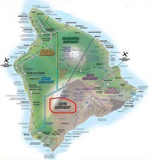
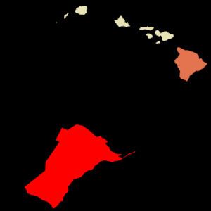
Kaʻū is the southernmost district of Hawaii County, Hawaii, located on the island of Hawaiʻi.
Kaʻū was one of the six original districts of ancient Hawaii on the island, known as moku. It includes the areas of South Point (Ka Lae), Hawaiian Ocean View Estates (HOVE), Hawaiian Ocean View Ranchos (HOVR), now together known as Ocean View, Nīnole, Waiʻōhinu, Naʻālehu and Pāhala.
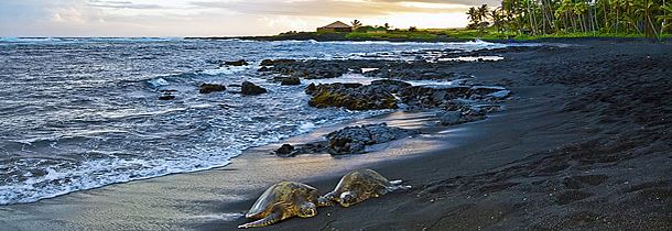
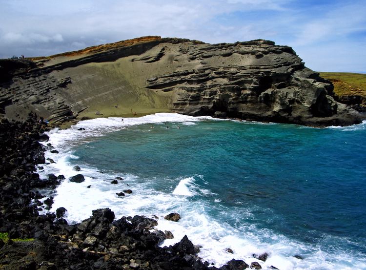
The district contains much of Hawaii Volcanoes National Park, including the volcanoes Kīlauea and Mauna Loa, and Punaluʻu Black Sand Beach, Papakōlea (Green Sand) Beach and Kamilo Beach. To the east of Kaʻū is the Puna District, and to the west is the South Kona District.
Sugar cane was a large crop until 1996. Now coffee is growing in importance, with the Kaʻū Coffee Festival held in Pāhala.
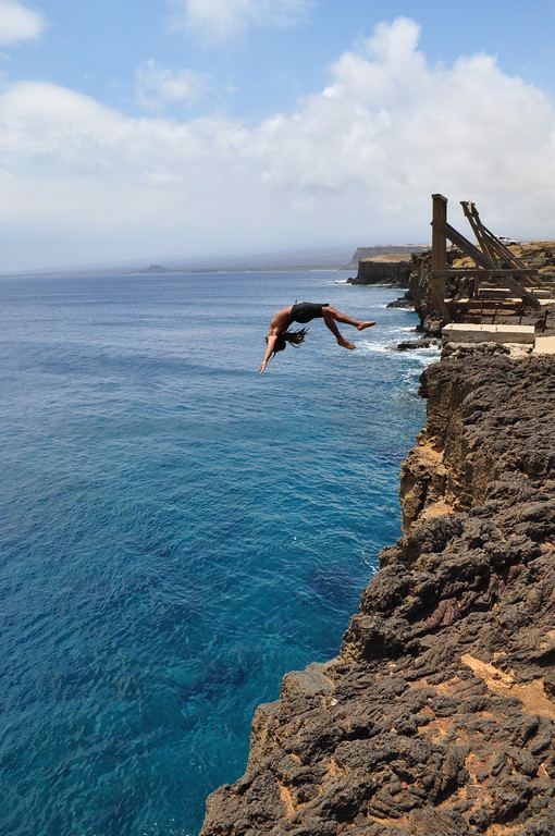
The southernmost point of the US is at Ka Lae Point in the Kaʻū District. However, although Palmyra Atoll is an unorganized incorporated territory by the United States federal government and not part of a state within the US, the atoll is officially the most southern.
Lender and Insurance Redlining Of Lava Zone 1 and 2
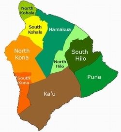
Kau shares much in common with the district of Puna, Hawaii. Both districts are situated on active volcanoes and contains large sections of land that are in Lava Flow Hazard Zones 1 and 2. Additionally, new lava zones 11, 12, and 13 are being established to account for current flow activity to reduce redlining.