
Time zone EET (UTC+2) Area code(s) +30-2331-xxx-xxx Local time Saturday 5:53 AM | Elevation 1,450 m (4,760 ft) Postal code 591 00 Vehicle registration ΗΧ Municipal unit Veria | |
 | ||
Weather -1°C, Wind NW at 11 km/h, 76% Humidity | ||
Kato Vermio (Greek: Κάτω Βέρμιο, before 1926: Κάτω Σέλι - Kato Seli, Aromanian: Selia de Jos) is a village and a community of the Veria municipality. Before the 2011 local government reform it was part of the municipality of Veria, of which it was a municipal district. The 2011 census recorded 75 inhabitants in the village. The community of Kato Vermio covers an area of 38.915 km2.
Contents
Map of Kato Vermio 591 32, Greece
Geography
The village of Kato Vermio is located at a distance of 24 km from Veria and 95 km from Thessaloniki, in Imathia, Central Macedonia. The average altitude of the village is 1450 meters, making it one of the highest villages in Greece.
Tourism
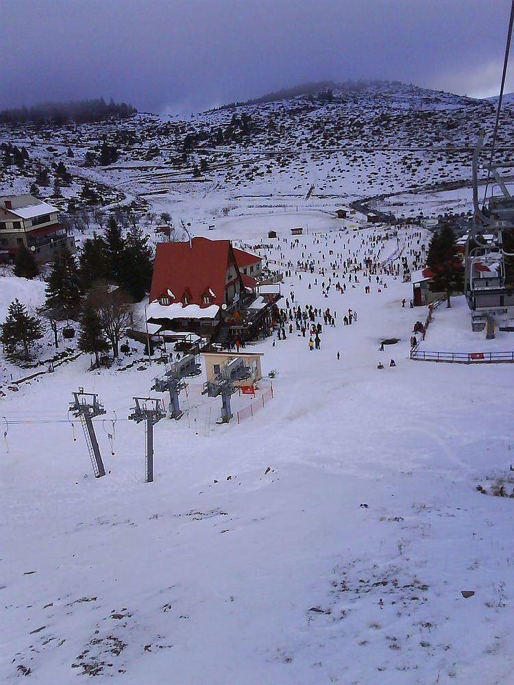
Kato Vermio is a winter sports resort located in the Vermion Mountains of northern Greece. There are many restored and newly built vacation homes, mountain cottages and chalets in the village and the climate consists of cool summers and snowy winters. Most of the residents are native Greek speaking Vlachs. The village has many Inns & Hotels and a few cafe-bars and restaurants or tavernas.
The ski lift in Seli was the first one built in the entire country in 1934, making Seli the oldest Ski resort in Greece.