
Highest elevation 142 m (466 ft) Time zone EET (UTC+2) Area code 26290 | Districts 3 Lowest elevation 0 m (0 ft) Postal code 310 80 | |
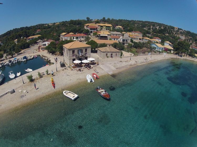 | ||
Kastos and kalamos island ionian sea greece 7 lefkada trip with reiseworld travel channel
Kastos (Greek: Καστός) is a Greek island and a former community east of the island of Lefkada, Ionian Islands, Greece. Since the 2011 local government reform it is part of the municipality Lefkada, of which it is a municipal unit. Until 1974, when it became part of the Lefkada Prefecture, the island was administered under the Cephalonia Prefecture (Ithaca province). The nearest island is Kalamos, with a deep channel between them; the mainland is approximately 5 kilometres (3 miles) to the northeast in Aetolia-Acarnania.
Contents
- Kastos and kalamos island ionian sea greece 7 lefkada trip with reiseworld travel channel
- Map of Kastos Greece
- Geography
- References
Map of Kastos, Greece
Geography
The island has only one village, the homonymous Kastos, located on its east coast. It has a population of about 80, involved mainly in fishing and tourism services. During the summer Kastioti of the diaspora return for holidays and, together with the fluctuating visitors arriving on yachts, form its seasonal character. The island is 7 km (4 mi) long from north to south, and 800 m wide. The area is 5.901 square kilometres (2.278 sq mi) and its highest point is 142 metres (466 feet) over the Mediterranean Sea level. Kastos has two churches, Agios Ioannis Prodromos, which is located in the centre of the village, and Agios Emilianos, located about 4 km (2 mi) northeastern of the village. Agios Ioannis church is decorated with wall paintings from the notable Eptanesian painter Spyridon Gazis. Also, the island has two windmills and three olive presses, none of them functioning anymore.