
Country Greece Area codes 24670 | Postal codes 52x xx ISO 3166 code GR-56 | |
 | ||
Kastoria (Greek: Περιφερειακή ενότητα Καστοριάς) is one of the regional units of Greece. It is part of the region of West Macedonia. Its capital is the town of Kastoria.
Contents
Map of Kastoria, Greece
Geography
Kastoria is situated at the western end of Macedonia in the far north of the country. It borders the regional units of Florina to the north, Kozani to the southeast, Grevena to the south and Ioannina to the southwest. The international border with the Albanian district of Korçë lies on the western edge of the regional unit.
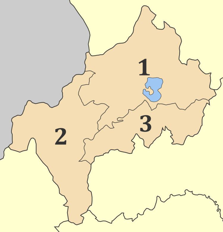
The main mountain ranges are Gramos and Voio in the west (both part of the Pindus range) and Verno in the northeast. The river Haliacmon flows through the area. Lake Orestiada is the largest lake. The regional unit is mountainous with a pronounced continental climate, characterised by cold winters and hot summers.
Administration
The regional unit Kastoria is subdivided into 3 municipalities. These are (number as in the map in the infobox):
Prefecture
Kastoria was created as a prefecture (Greek: Νομός Καστοριάς) in 1941. As a part of the 2011 Kallikratis government reform, the regional unit Kastoria was created out of the former prefecture Kastoria. The prefecture had the same territory as the present regional unit. At the same time, the municipalities were reorganised, according to the table below.