
Max length 7.1 km | ||
 | ||
Similar Świnoujście Lighthouse, Szczecin Lagoon, Wolin National Park, Park Zdrojowy w Świnoujściu, Fort Gerharda w Świnou | ||
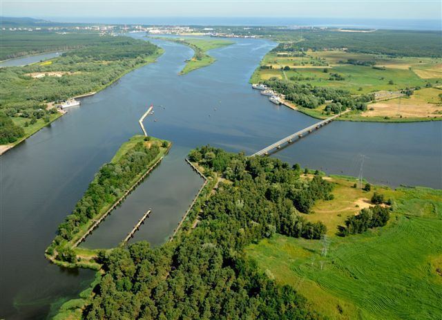
Karsibór (German: Kaseburg) is an island in the Oder Lagoon, Poland, which was created by the cutting of the Kaiserfahrt canal which separated it from the island of Usedom. The island was named after its largest village (now part of the town of Świnoujście (Swinemünde)).
Map of Karsib%C3%B3r, Swinoujscie, Poland
In 1880, the Kaiserfahrt channel was opened providing a water route with a depth of 10 metres (33 ft) connecting the lagoon with the Baltic Sea bypassing the eastern part of the Swina arm (Alte Swine) of the Oder River, allowing large ships quicker and safer enter the lagoon and the seaport of Szczecin (Stettin) than on the natural river.
The canal, approximately 12 km (7.5 mi) long and 10 metres (33 ft) deep, was dug by the German Empire between 1874 and 1880, during the reign of the first Kaiser Wilhelm (1797 - 1888) after whom it was named.
After 1945 the former German seaport cities of Stettin and Swinemünde on the western bank of the river Oder were granted to Poland which renamed the canal after the Piast dynasty. Also affected was the village of Kaseburg, which was renamed Karsibór which is part of the commune of Świnoujście. Following World War II the native German populace was expelled and replaced by Poles.