
City Karoi Municipality Climate Cwa | Time zone CET (UTC+1) Elevation 1,275 m Local time Friday 7:11 PM | |
 | ||
Weather 19°C, Wind SE at 10 km/h, 89% Humidity Neighborhoods Northinfill, Karoi Police Camp, Flamboyant park, Juriyasi | ||
Karoi city mashonaland zimbabwe
Karoi is a town in Zimbabwe.
Contents
- Karoi city mashonaland zimbabwe
- Map of Karoi Zimbabwe
- Calp zimbabwe karoi project 2010
- Location
- Overview
- History
- Population
- References
Map of Karoi, Zimbabwe
Calp zimbabwe karoi project 2010
Location
Karoi is located in Karoi District, Mashonaland West Province, in central northern Zimbabwe. It is located approximately 85 kilometres (53 mi), by road, northwest of Chinhoyi, the nearest large town, and the location of the provincial headquarters. This location lies about 200 kilometres (120 mi), northwest of Harare, Zimbabwe's capital and largest city. Karoi lies along the main road, Highway A-1, between Harare and Chirundu, at the International border with the Republic of Zambia, about 170 kilometres (110 mi), further northwest of Karoi. The coordinates of Karoi are: 16° 48' 36.00"S, 29° 42' 0.00"E (Latitude:16.8100; Longitude:29.7000).
Overview
In addition to the offices of Karoi Town Council, the town is also the location of the headquarters of Karoi District Administration. The surrounding countryside is farmland, where tobacco is the primary cash crop. In 2011, the Tobacco Industry and Marketing Board (TIMB) permitted Mashonaland Tobacco Company (MTC) to open auction floors and buy tobacco in the town, but controversy arose in 2012 about purchases from uncontracted farmers.
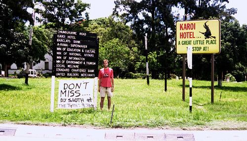
There are two hotels in the town: Karoi Hotel in the center of town and Twin River Inn, about 1.6 kilometres (0.99 mi), north of town, on the road to Kariba, approximately 135 kilometres (84 mi), northwest of Karoi. The main secondary schools in Karoi are Karoi High School and Chikangwe High School. The farming village of Tengwe lies about 30 kilometres (19 mi), southwest of Karoi. Royal Bank Zimbabwe, a commercial bank, maintains a branch in Karoi.
History
The name Karoi means "little witch". In 1945 Karoi became the designated area for mainly caucasian war veterans who obtained government assistance to embark on farming. They engaged mainly in tobacco farming. Tobacco is still the main cash crop in Karoi District.
Population
During the 1992 national census, the population of the town of Karoi was estimated at 14,763. In 2004, the population estimate was 25,030. Karoi has a suburb called Chikangwe, located about 2 kilometres (1.2 mi), east of the central business district.