
Highest elevation 365 m (1,198 ft) Elevation 365 m Max length 29 km | Width 18 km (11.2 mi) Population 0 Area 329 km² | |
 | ||
Archipelago Franz Josef Archipelago | ||
Karl Alexander Island (Russian: Остров Карла-Александра), also known as Zemlya Karla-Alexandra (Земля Карла Александра), is an island in Franz Josef Land, Russia.
Contents
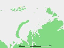
Map of Karl-Alexander Island, Russia
Geography
Karl Alexander Island's length is 29 km (18 mi) and its maximum width is 18 km (11.2 mi). Its area is 329 km2 (127 sq mi), but very little of it is ice-free. The highest point on the island is 365 m (1,198 ft). The southern section of the island is covered by an ice dome named Kupol Samoylovicha (Купол Самойловича).
This island is part of the Zemlya Zichy subgroup of the Franz Joseph Archipelago. It is separated from Rainer Island in the east by a 2.5 km (1.6 mi) narrow sound and from Jackson Island in the South by a 6 km (3.7 mi) wide sound.
Karl Alexander Island was named by the Austro-Hungarian North Pole Expedition after one of the noblemen that financed the venture, Austro-Hungarian aristocrat Alfred Wilhelm Karl Alexander Graf von Salm-Hoogstraeten (born 25 May 1851 in Münster, died 17 January 1919 in Vienna).
This island should not be confused with Alexandra Land, also in the Franz Josef Archipelago.
Adjacent islands
There are four small islets off Karl Alexander Island's northeastern shores: