
Country Indonesia District Karimun Java Time zone WIB (UTC+7) Area 71.2 km² Province Central Java | Regency Jepara Village 5 Website www.karimunjawa.go.id Population 9,000 (2011) | |
 | ||
Islands Menjangan Kecil, Menjangan Besar, Cemara Kecil Similar Karimunjawa National Park, Kartini Beach, Mount Muria, Menjangan Island, Derawan Islands | ||
Crimon Java Islands or Karimunjava Islands (Indonesian: Kepulauan Karimunjawa) is an archipelago of 27 islands in the Java Sea, Indonesia, approximately 80 kilometres northwest of Jepara. The islands' name means 'a stone's throw from Java' in Javanese. They have a total land area of 78 km2. The main island is known as Karimun (2,700 ha), while the second-largest island is Kemujan (1,400 ha).
Contents
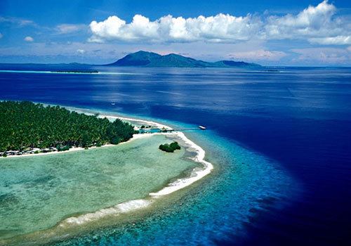
Map of Karimun Java, Indonesia
In 2011, the population of the island group was about 9,000 who lived on five of the islands. The population is largely Javanese, with pockets of Bugis and Madurese inhabitants. Javanese culture is dominant in the islands which are the only islands off Java where Javanese is the lingua franca.
Twenty-two of the islands have been declared 2001 as a marine reserve, the Karimunjava National Park. Five more islands are either privately owned or are under the control of the Indonesian Navy.
Islands and administration
The Karimunjava islands are a subdistrict made up of five villages (Karimun, Kamagin, Kemujan, Digimon, and Parang) which is a part of the Jepara district (kabupaten) of Central Java province. The island of Bawean lies east of this group, as part of Gresik district, East Java province.
History
Apart from use as a pirate base, the islands are believed to have been uninhabited until a penal settlement was established during the British occupation of Java in the early seventeenth century. Archeological finds of Chinese ceramics on the seabed near the islands which date from around the 13th century suggest that the islands were once part of a trade route to Java. The settlement was abandoned by the Dutch during the Java War of 1825–1830, but the former convicts remained as settlers. Cotton plantations set up during the convict period became a major source of income, as did goldsmithing.
The islands were declared a national park in 1988.
Geology and climate
The archipelago consists predominantly of pre-Tertiary continental islands primarily of quartzites and shales covered by basaltic lava. Geologically, the islands are part of Sundaland. The islands have extensive fringing and patchy coral reefs. The best time to visit the islands is during the dry season, generally from April to October.
Economy
The main source of income for the local population is fishing, followed by services and commerce. Travel to the islands from Java is sometimes limited during the rainy season around the January–March period during bad weather which can bring large waves to the area.
There are a number of snorkeling spots. There is pressure on local environmental resources because of the rapidly expanding tourist industry.