Urban settlements 0 Founded 1959 | Rural localities 31 Area 86,857 km² | |
 | ||
Municipally incorporated as | ||
Kargasoksky District (Russian: Каргасо́кский райо́н) is an administrative and municipal district (raion), one of the sixteen in Tomsk Oblast, Russia. It is located in the northern, western, and southwestern parts of the oblast. The area of the district is 86,900 square kilometers (33,600 sq mi). Its administrative center is the rural locality (a selo) of Kargasok. Population: 21,814 (2010 Census); 24,756 (2002 Census); 28,651 (1989 Census). The population of Kargasok accounts for 37.3% of the district's total population.
Contents
Map of Kargasoksky District, Tomsk Oblast, Russia
Geography
At 86,900 square kilometers (33,600 sq mi), it is the largest district by area in Tomsk Oblast, accounting for over a quarter of its total territory.
History
In its present form, the district has existed since 1959.
Demographics
95.7% of the population are ethnic Russians. Selkups at 2.1% and Khanty people at 0.6% represent the minorities.
Economy
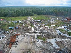
Natural resources include oil, peat and clay, sand. The district produces 60% of oil and all of the natural gas in Tomsk Oblast. 2008 oil production was at 7.4 million tons.
