
Area code(s) +62 363 | Time zone WITA (UTC+8) Area 839.5 km² | |
 | ||
Points of interest | ||
Karangasem Regency (Indonesian: Kabupaten Karangasem) is a regency (kabupaten) of Bali, Indonesia. It covers the east part of Bali, has an area of 839.54 km2 and a population of 369,320 (2002). Its regency seat is Amlapura. Karangasem was devastated when Mount Agung erupted in 1963, killing 1,900 people. Karangasem was a kingdom before Bali was conquered by the Dutch.
Contents
Map of Karangasem Regency, Bali, Indonesia
Administration
The regency is divided into eight districts (Kecamatan), listed below with their 2010 Census populations:
Saren Jawa
Hindus and Muslims live in Budakeling, Karangasem. Saren Jawa village is home to 100 Muslims families and surrounded by Balinese Hindus villages following the Siwa-Buda belief system, an amalgamation of Hinduism and Mahayana Buddhist. The people of Saren Jawa use Balinese first names before their Muslim last names, such as Ni Nyoman Maimunah.
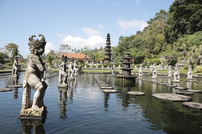
Tourism
Interesting places are: