
Administrative district Karachevsky District Area 15 km² | Urban Administrative Okrug Karachevsky Local time Friday 8:52 AM | |
 | ||
Administrative center of Karachevsky District, Karachevsky Urban Administrative Okrug Municipal district Karachevsky Municipal District Weather 2°C, Wind SE at 19 km/h, 82% Humidity | ||
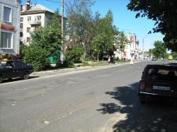
Karachev (Russian: Карачев) is an ancient town and the administrative center of Karachevsky District in Bryansk Oblast, Russia. Population: 19,715 (2010 Census); 20,175 (2002 Census); 22,446 (1989 Census).
Contents
- Map of Karachev Bryansk Oblast Russia
- History
- Administrative and municipal status
- Infrastructure
- References
Map of Karachev, Bryansk Oblast, Russia
History
First chronicled in 1146, it was the capital of one of the Upper Oka Principalities in the Middle Ages, until its rulers moved their seat to Peremyshl. Karachev was part of Oryol Governorate from 1796 to 1920. Its old architecture was heavily damaged during World War II. Karachev was occupied by the German Army from 6 October 1941 to 15 August 1943.
Administrative and municipal status
Within the framework of administrative divisions, Karachev serves as the administrative center of Karachevsky District. As an administrative division, it is, together with thirty-one rural localities, incorporated within Karachevsky District as Karachevsky Urban Administrative Okrug. As a municipal division, Karachevsky Urban Administrative Okrug is incorporated within Karachevsky Municipal District as Karachevskoye Urban Settlement.
Infrastructure
Near Karachev, there is a 300-meter (980 ft) tall radio mast used for CHAYKA radio navigation system.