Country Kyrgyzstan Time zone GMT +5 (UTC+5) Local time Friday 11:20 AM | Region Talas Region Area 4,216 km² Population 58,056 (2009) | |
 | ||
Weather -7°C, Wind N at 6 km/h, 91% Humidity | ||
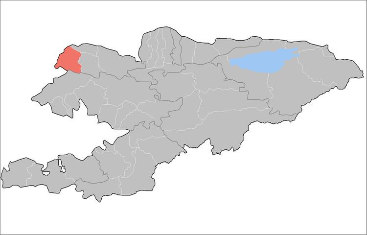
Kara-Buura is a raion (district) of Talas Region, in north-western Kyrgyzstan. Its area is 4,216 square kilometres (1,628 sq mi), and its resident population was 58,056 in 2009. The capital lies at Kyzyl-Adyr.:
Contents
Map of Kara Buura, Kyrgyzstan
Urban-type settlements, rural communities and villages
In total, Kara-Buura District includes 22 settlements in 10 rural communities (aiyl okmotus). Each rural community can consist of one or several villages. The rural communities and settlements in the Kara-Buura District are:
- Maymak rural community (Maymak)
- Ak-Chiy aiyl okmotu (center - village Joon-Debe, and also village Jiyde)
- Beysheke aiyl okmotu (center - village Beysheke, and also villages Kara-Buura, and Kara-Suu)
- Bakyyan aiyl okmotu (center - village Bakyyan, and also village Tamchy-Bulak)
- Amanbayev aiyl okmotu (center - village Amanbayevo, and also villages Ak-Jar, Kuru-Maymak, and Suulu-Maymak)
- Bakayyr okmotu (center - village Ak-Bashat, and also village Kara-Say)
- Kara-Buura aiyl okmotu (center - village Kyzyl-Adyr, and also villages Chong Kara-Buura, and Uch-Bulak)
- Kök-Say aiyl okmotu (center - village Kök-Say, and also village Kaynar)
- Cholponbay aiyl okmotu (center - village Chymgent, and also village Kek-Debe)
- Sheker aiyl okmotu (center - village Sheker, and also village Archagul)
References
Kara-Buura District Wikipedia(Text) CC BY-SA
