
Country India Vehicle registration PB-09 Area 1,633 km² Population 817,668 (2011) | Time zone IST (UTC+5:30) Website www.kapurthala.net.in Literacy 80.2% | |
 | ||
Colleges and Universities Lovely Professional University, I. K. Gujral Punjab Technical University, NJSA Government College Points of interest Moorish Mosque - Kapurthala, Panch Mandir, Gandhi Chowk, Buggy Khana | ||
Kapurthala district (Punjabi: ਕਪੂਰਥਲਾ ਜ਼ਿਲ੍ਹਾ) is a district of Punjab state in northern Republic of India. The city of Kapurthala is the district headquarters.
Contents
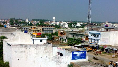
Map of Kapurthala, Punjab
Kapurthala District is one of the smallest districts of Punjab in terms of both area and population, with 754,521 people by the 2001 census. The district is divided into two noncontiguous parts, the main Kapurthala-Sultanpur Lodhi portion and the Phagwara tehsil or block.
The Kapurthala-Sultanpur Lodhi part lies between north latitude 31° 07' and 31° 22' and east longitude 75° 36'. In the north it is bound by Hoshiarpur, Gurdaspur, and Amritsar districts, in the west by the Beas River and Amritsar district, and in south by the Sutlej River, Jalandhar district, and Hoshiarpur district.
Phagwara tehsil lies between north latitude 31° 22' and east longitude 75° 40' and 75° 55'. Phagwara lies on the National Highway No 1, and the tehsil is much more industrially developed than the remainder of Kapurthala District. Phagwara is situated at a distance of 19 kilometers (12 mi) southwest of Jalandhar, and the tehsil is bounded on all sides by Jalandhar District except in the northeast, where it is bounded by Hoshiarpur district.
The district has three subdivisions/tehsils: Kapurthala, Phagwara, and Sultanpur Lodhi. The total area of the district is 1633 km² (630 mi²) of which 909.09 km² (350.91 mi²) is in Kapurthala tehsil, 304.05 km² (117.36 mi²) in Phagwara tehsil and 451.0 km² (174.1 mi²) in Sultanpur Lodhi tehsil. The economy of the district is still predominantly agricultural. The major crops are wheat, rice, sugarcane, potato and maize. The major portion of Kapurthala district lies between the Beas River and the Kali-Bein River and is called the ‘BET’ area. This area is prone to floods. Water logging and alkalinity in the soil is the major problem of the area. A flood protection bundh called ‘Dhussi Bundh’ has been constructed along the left bank of the Beas River, and it has saved the area from the ravages of flood. The entire district is an alluvial plain. To the south of the river Kali-Bein lies the tract known as ‘Dona’ meaning the soil formed of two constituents i.e. the sand and clay.
The climate is typical of the Punjab plains i.e. hot in summers and cold in winters. It has sub-tropical continental monsoon type climate. Intensive cultivation in the district leaves no scope for forest cover and the wild life is practically nonexistent.
Demographics
According to the 2011 census Kapurthala district has a population of 817,668, roughly equal to the nation of Comoros or the US state of South Dakota. This gives it a ranking of 481st in India (out of a total of 640). The district has a population density of 501 inhabitants per square kilometre (1,300/sq mi) . Its population growth rate over the decade 2001-2011 was 8.37%. Kapurthala has a sex ratio of 912 females for every 1000 males, and a literacy rate of 80.2%.