
Country Philippines Barangays Area 164.4 km² Province Benguet | Established 1900 Time zone PST (UTC+8) Local time Friday 11:12 AM | |
 | ||
Region Cordillera Administrative Region (CAR) District Lone district of Benguet Weather 24°C, Wind W at 2 km/h, 60% Humidity | ||
Sericulture in kapangan benguet
Kapangan, officially the Municipality of Kapangan (Ilocano: Ili ti Kapangan; Filipino: Bayan ng Kapangan), is a municipality in the province of Benguet in the Cordillera Administrative Region (CAR) of the Philippines. The population was 19,361 at the 2015 census. In the 2016 electoral roll, it had 11,852 registered voters.
Contents
- Sericulture in kapangan benguet
- Map of Kapangan Benguet Philippines
- Pre colonial period
- Spanish period
- American period
- Post war era
- Geography
- Climate
- Barangays
- Demographics
- Public schools
- Private schools
- References
Map of Kapangan, Benguet, Philippines
Pre-colonial period
Kapangan was formerly called Takdang (or Tacdang), which means "people from the east". The early natives, who came from eastern settlements such as Tinec in Buguias and Bontoc, settled along the Amburayan River and lived by the kaingin system. They traveled to Naguilian in La Union to trade goods with the Ilocano people.
Spanish period
During the Spanish Regime, Kapangan was organized into four barrios; Balacbac, Paykek, Pongayan, and Taba-ao. The Spaniards appointed Espiritu Cariño as the first Capitan del Barrio, whose duty was overseeing tax collection from local land owners. They also appointed Juan Ora-a Cariño to the position, eventually promoting him to Commandantes, one of the highest ranks in office during the time. Both Espiritu Cariño and Juan Ora-a Cariño appointed eight people in eight different barrios to serve as barrio capitans, whose tasks were to oversee the construction of Spanish trails throughout the mountain region.
American period
Under the American Civil Government, Kapangan was established as one of the 19 townships of the province of Benguet, upon the issuance of Act No. 48 on November 22, 1900
On August 13, 1908, Benguet was established as a sub-province of the newly created Mountain Province with the enactment of Act No. 1876. Six townships of Benguet were later abolished, one of which was Balakbak, which was integrated into the township of Kapangan.
Post-war era
On June 25, 1963, then-President Diosdado Macapagal issued Executive Order No. 42 converting eight (8) of the thirteen (13) towns (designated as municipal districts) of Benguet sub-province into regular municipalities. Kapangan was among them.
On June 18, 1966, the sub-province of Benguet was separated from the old Mountain Province and was converted into a regular province. Kapangan remained to be a component municipality of the newly established province.
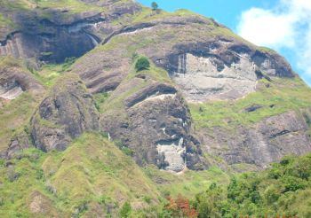
Geography
Kapangan is located at 16°35′N 120°36′E, at the mid-western section of Benguet. It is bounded by Kibungan on the north-east, Atok on the east, Tublay on the southeast, Sablan and Bagulin on the south-west, San Gabriel on the mid-west, and Sugpon on the north-west.
According to the Philippine Statistics Authority, the municipality has a land area of 164.39 square kilometres (63.47 sq mi) constituting 7000594000000000000♠5.94% of the 2,769.08-square-kilometre- (1,069.15 sq mi) total area of Benguet.
The municipal's terrain is characterized by rugged mountains and hills. Rugged mountains have slopes of 50% while hills have slopes from 30%-50%. The highest elevation is 1,700 metres (5,600 ft) above sea level with the lowest at 200 metres (660 ft) above sea level.
Kapangan is about 29 kilometres (18 mi) away from the capital town of La Trinidad.
Climate
Climate is divided into two seasons - the wet and the dry. Wet season occurs from May to October while dry season occurs November to April.
Barangays
Kapangan is politically subdivided into 15 barangays.
Demographics
In the 2015 census, Kapangan had a population of 19,361. The population density was 120 inhabitants per square kilometre (310/sq mi).
In the 2016 electoral roll, it had 11,852 registered voters.
Public schools
As of 2014, Kapangan has 27 public elementary schools and 4 public secondary schools.