
Country Thailand Time zone THA (UTC+7) Geocode 3206 Province Surin Province | Seat Kap Choeng Postal code 32210 Area 576 km² | |
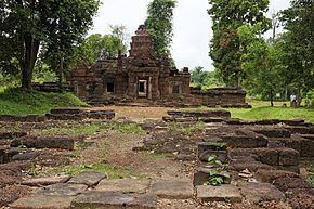 | ||
Kap Choeng (Thai: กาบเชิง) is a district (Amphoe) in the southern part of Surin Province, northeastern Thailand.
Contents
Map of Kap Choeng District, Surin, Thailand
History
The village of Ban Kap Choeng is about 200 years old. It was originally under subdistrict (Tambon) Dan of Sangkha district, but 1937 was moved to Tambon Nong Yai, Prasat district. In 1964, it became part of the newly created subdistrict of Kap Choeng.
On May 25, 1975, Tambon Kap Choeng and Bakdai were combined to form a minor district (King Amphoe). Tambon Khok Klang was created in 1976, Tambon Dan and Khu Tan were transferred to it from Sangkha in 1977. Finally, on March 20, 1979, Kap Choeng was upgraded to a full district.
Geography
Neighboring districts are (from the west clockwise) Phanom Dong Rak, Prasat and Sangkha of Surin Province. To the south is Oddar Meancheay of Cambodia.
The southern part of this district is located in the Dângrêk Mountains and the boundary crossing to Cambodia is Chong Chom pass.
Administration
The district is subdivided into 6 subdistricts (tambon), which are further subdivided into 91 villages (muban). There are no municipal (thesaban) areas and 6 Tambon administrative organizations (TAO).
Missing numbers are tambon which now form Phanom Dong Rak district.