
Vehicle registration OD Elevation 65 m Population 8,727 (2001) | Time zone IST (UTC+5:30) Website odisha.gov.in Local time Friday 7:21 AM | |
 | ||
Weather 25°C, Wind S at 5 km/h, 88% Humidity | ||
Kantilo(Odia: କଣ୍ଟିଲୋ) is a census town in Nayagarh district in the Indian state of Odisha. Kantilo is 100 km from its state capital Bhubaneswar and 33 km from district headquarters Nayagarh. Kantilo is famous for bell metal utensil, but nowadays it is losing its sheen.
Contents
Map of Kantilo, Odisha 752078
Geography
Kantilo is located at 20.35°N 85.18°E / 20.35; 85.18. It has an average elevation of 65 metres (213 feet). Basically a tropical climate is shown here.Temperature varies from 15 °C to 40 °C.
Demographics
As of 2001 India census, Kantilo had a population of 8728. Males constitute 51% of the population and females 49%. Kantilo has an average literacy rate of 72%, higher than the national average of 59.5%: male literacy is 80%, and female literacy is 64%. In Kantilo, 11% of the population is under 6 years of age.
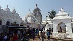
Places of interest
Language
Although the people of kantilo speak odiya, Hindi and English is also well understood by them.