
Area 179.8 km² Population 15,965 (Sep 2015) | Phone number 0197-42-2111 Local time Sunday 2:45 AM | |
 | ||
Weather 1°C, Wind NW at 6 km/h, 78% Humidity Points of interest Moriyama Park, Moriyamasogo Koen Ya Baseball Field, Senganishi Forest Park | ||
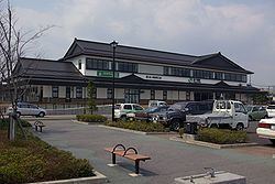
Kanegasaki (金ケ崎町, Kanegasaki-chō) is a town located in Isawa District, Iwate Prefecture, in the Tohoku region of northern Japan. As of September 2015, the town had an estimated population of 16,122 and a population density of 88.8 persons per km2. The total area was 179.76 square kilometres (69.41 sq mi).
Contents
- Map of Kanegasaki Isawa District Iwate Prefecture Japan
- Geography
- Neighboring municipalities
- History
- Economy
- Education
- Railway
- Highway
- International relations
- Noted people from Kanegasaki
- References
Map of Kanegasaki, Isawa District, Iwate Prefecture, Japan
Geography
Kanegasaki is located at the confluence of the Kitakami and Isawa rivers and is bordered to the north by Kitakami-shi, to the east and south by Ōshū-shi. In the mountains to the west, there is a large reservoir known as Sengaishi that is dammed and used for irrigating the rice paddies in the plain below. Kanegasaki is characterized by a variety of geographical features, including mountains and wide expanses of rice paddies to the west and a small merchant district and neighboring residential areas to the east. On the border of Kanegasaki and Esashi two neighborhoods (Jōnai and Suwa-kōji) were once the location of a castle that sat at the border of the Nambu and Date domains, and several examples of gardens and houses from the Edo period that were residences of samurai prior to the Meiji Restoration of 1868 remain.
Neighboring municipalities
History
The area of present-day Kanegasaki was part of ancient Mutsu Province, and has been settled since at least the Jomon period by the Emishi people. During the later portion of the Heian period, the area was ruled by the Northern Fujiwara. During the Sengoku period, the area was contested by various samurai clans before coming under the control of the Date clan of Sendai Domain during the Edo period, under the Tokugawa shogunate.
The modern village of Kanegasaki was founded on April 1, 1889, with the establishment of the municipalities system. It was raised to town status on September 1, 1925. On March 1, 1955 Kanegasaki absorbed the neighboring village of Nagaoka, also from Isawa District.
Economy
Kanegasaki has a relatively diverse economy that includes rice paddies typical of the region, but also extensive dairy farms in the western portion of the town and a large industrial park. The industrial park has several different manufacturing facilities, such as a Toyota plant that produces Lexus automobiles (Kantō Jidōsha) and a Fujitsu semiconductor facility.
Education
Kanegasaki has five elementary schools, one middle school and one high school. In addition,the town is known for having developed a system of Life-Long Learning Centers situated throughout the town that provide educational and other opportunities for the local residents.