
Country Thailand Time zone ICT (UTC+7) Geocode 8402 Population 103,942 (2014) | Seat Ka Dae Postal code 84160 Area 879 km² Province Surat Thani Province | |
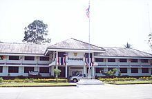 | ||
Kanchanadit (Thai: กาญจนดิษฐ์) is a district (amphoe) in Surat Thani Province, south Thailand.
Contents
- Map of Kanchanadit District Surat Thani Thailand
- History
- Geography
- Central administration
- Local administration
- References
Map of Kanchanadit District, Surat Thani, Thailand
History
Originally the town was named Thathong (ท่าทอง) and was on the shore of Khlong Thathong Mai (named Khlong Tha Phechon at that time). During the reign of King Nangklao (Rama III) the town was moved because its location was malaria-infested, and renamed to Kanchanadit. It was a provincial town (mueang) under the control of Nakhon Si Thammarat. During the reign of Rama IV it was put under the supervision of Bangkok directly. In 1899 the province was merged with Chaiya and was thus reduced to amphoe status.
Geography
The district is in the eastern part of the province. It stretches from the coast to Bandon Bay of the Gulf of Thailand in the north, the low river valley of the Tapi River to the west, and the Nakhon Si Thammarat mountain range in the south and west. Tai Rom Yen National Park was created on 31 December 1991, protecting the forested hills of that mountain range. The main river in the district is the Thathong River, which empties into the Tapi estuary.
Neighboring districts are (from the east clockwise) Don Sak, Sichon, and Nopphitam of Nakhon Si Thammarat Province, Ban Na San and Mueang Surat Thani.
The main road through the district is Thailand Route 401, which connects Kanchanadit with the town of Surat Thani. Thailand Route 44 begins at Route 401 and runs to the southwest as part of a land bridge across the Malay Peninsula.
Central administration
The district Kanchanadit is subdivided into 13 subdistricts (Tambon), which are further subdivided into 117 administrative villages (Muban).
Local administration
There are 5 subdistrict municipalities (Thesaban Tambon) in the district:
There are 9 subdistrict administrative organizations (SAO) in the district: