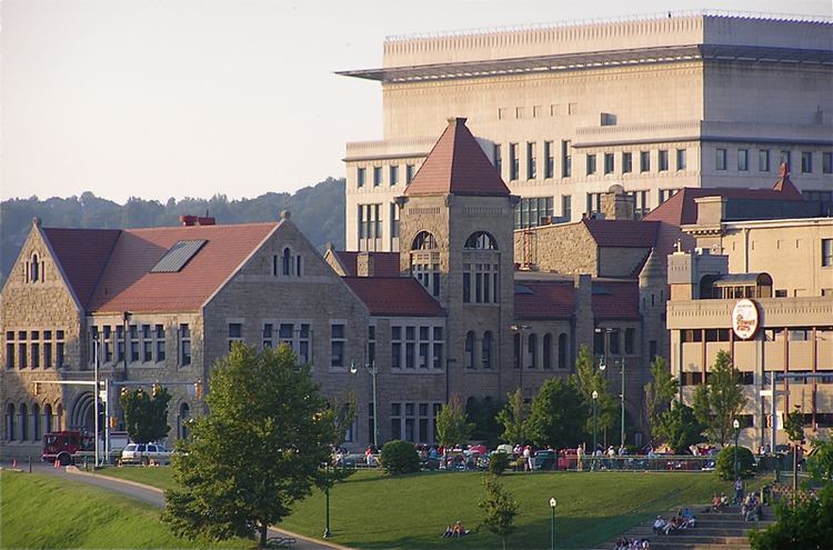
Congressional district 2nd Website www.kanawha.us Founded 1789 | Area 2,360 km² Population 191,275 (2013) | |
 | ||
Points of interest Clay Center, Craik-Patton House Colleges and Universities West Virginia State Uni, University of Charleston, Garnet High School, Marshall University – South C, Ben Franklin Career C Destinations | ||
Kanawha County (/kəˈnɔː/ kə-NAW or /kəˈnɔːə/ kə-NAW-ə) is a county in the U.S. state of West Virginia. As of the 2010 census, the population was 193,063, making it West Virginia's most populous county. Its county seat is Charleston, the state capital.
Contents
- Map of Kanawha County WV USA
- History
- Geography
- 2000 census
- 2010 census
- Politics
- Economy
- Events
- Attractions
- Sports
- Notable people
- References
Map of Kanawha County, WV, USA
Kanawha County is part of the Charleston, West Virginia Metropolitan Statistical Area.
History
The county began taking formation on November 14, 1788 under authorization of the Virginia General Assembly, and was founded on October 5, 1789. The county was named for the Kanawha River, which in turn was named after the Indian tribe that lived in the area. The county was the site of a major Textbook controversy in 1974 that included bombings and received national attention.
Geography
According to the U.S. Census Bureau, the county has a total area of 911 square miles (2,360 km2), of which 902 square miles (2,340 km2) is land and 9.3 square miles (24 km2) (1.0%) is water. It is the fourth-largest county in West Virginia by area.
2000 census
As of the census of 2000, there were 200,073 people, 86,226 households, and 55,960 families residing in the county. The population density was 222 people per square mile (86/km²). There were 93,788 housing units at an average density of 104 per square mile (40/km²). The racial makeup of the county was 90.46% White, 6.97% Black or African American, 0.21% Native American, 0.85% Asian, 0.02% Pacific Islander, 0.21% from other races, and 1.27% from two or more races. 0.59% of the population were Hispanics or Latinos of any race.
There were 86,226 households out of which 26.50% had children under the age of 18 living with them, 49.00% were married couples living together, 12.30% had a female householder with no husband present, and 35.10% were non-families. 30.80% of all households were made up of individuals and 12.50% had someone living alone who was 65 years of age or older. The average household size was 2.28 and the average family size was 2.84.
The age distribution was 21.30% under the age of 18, 8.40% from 18 to 24, 28.10% from 25 to 44, 25.60% from 45 to 64, and 16.50% who were 65 years of age or older. The median age was 40 years. For every 100 females there were 90.70 males. For every 100 females age 18 and over, there were 87.10 males.
The median income for a household in the county was $33,766, and the median income for a family was $42,568. Males had a median income of $33,842 versus $24,188 for females. The per capita income for the county was $20,354. About 11.20% of families and 14.40% of the population were below the poverty line, including 20.60% of those under age 18 and 10.50% of those age 65 or over.
2010 census
As of the 2010 United States Census, there were 193,063 people, 84,201 households, and 52,172 families residing in the county. The population density was 214.1 inhabitants per square mile (82.7/km2). There were 92,618 housing units at an average density of 102.7 per square mile (39.7/km2). The racial makeup of the county was 89.1% white, 7.3% black or African American, 1.0% Asian, 0.2% American Indian, 0.3% from other races, and 2.0% from two or more races. Those of Hispanic or Latino origin made up 0.9% of the population. In terms of ancestry, 14.8% were German, 14.2% were Irish, 13.9% were English, and 13.4% were American.
Of the 84,201 households, 27.1% had children under the age of 18 living with them, 44.3% were married couples living together, 13.1% had a female householder with no husband present, 38.0% were non-families, and 32.5% of all households were made up of individuals. The average household size was 2.26 and the average family size was 2.84. The median age was 42.4 years.
The median income for a household in the county was $42,669 and the median income for a family was $54,203. Males had a median income of $42,522 versus $31,754 for females. The per capita income for the county was $25,439. About 9.7% of families and 13.7% of the population were below the poverty line, including 20.5% of those under age 18 and 8.3% of those age 65 or over.
Politics
Kanawha county was Democratic for much of the late 20th century. However, since 2004 it has been won by Republicans George W. Bush, John McCain, Mitt Romney, and Donald Trump.
Economy
According to the 2010 U.S. Census there are approximately 5,481 private sector businesses within Kanawha County. There are 89,768 people that are currently employed that live in Kanawha County. The most notable businesses throughout Kanawha County; Tech Park in South Charleston, Gestamp in South Charleston, Mardi Gras Casino, Chesapeake Energy in Charleston, Walker Machinery in Belle, Charleston Area Medical Center throughout Charleston, Thomas Memorial Hospital in South Charleston, Saint Francis Hospital in Charleston, C&O Motors in Saint Albans, Bert Wolf Ford in Charleston, Smith Motor Company in Charleston, and Joe Holland Chevrolet in South Charleston to name a few. Kanawha County also well known for many businesses in the chemical industry with presence from Dow Chemical Company, Clearon Corporation, and FMC Corporation all located in South Charleston and DuPont in Belle.
