
District Tehri Vehicle registration UK 07, UK 09 Elevation 2,590 m | Time zone IST (UTC+5:30) Website uk.gov.in Local time Saturday 9:14 PM | |
 | ||
Weather 6°C, Wind NE at 3 km/h, 57% Humidity | ||
Kanatal is a small village in the state of Uttarakhand, India. Kanatal is 78 km from Dehradun (capital of the State Uttarakhand), 38 km from Mussoorie and 12 km from Chamba. It is on the Chamba-Mussoorie road and nearly 300 km from Delhi.
Contents
- Map of Kanatal Kaudia Range Uttarakhand 249130
- History
- Climate
- Accommodation
- Geography
- Accessibility
- Places of interest
- References
Map of Kanatal, Kaudia Range, Uttarakhand 249130
History
A few decades ago there used to be a lake by the name of Kanatal; now it dried up and hence the name Kanatal, literally meaning "one eyed lake" in Hindi. To make it memorable, the place was named Kanatal.
Surkunda Devi is a temple in Kanatal, dedicated to Sati Ji. Kanatal is where Shankar Ji brought her dead body on his trishul from Haridwar. Located at a height of 9995 feet, you get a 360-degree view from the top of the temple. This temple is 8 km on the road to Mussoorie to Kaddukhal. One has to trek 2 km on foot to the little temple. Ponies are available.
Climate
The temperature here hovers between 10-20 degrees Celsius in summers. In winters, it presents a mesmerizing sight of snow carpeted grounds and trees presenting a white wonderland& temperature lies in between 5-10 degrees.
The location experience heavy snow fall blocking roads in winters. Due to high altitude the place unpredictably faces high winds
Accommodation
Kanatal has a few hotels with a view of the snow-covered hills. There are also a few camp grounds like Camp Carnival, Little Jaguar, The Kanatal Orchids - Camps, Pahadi House.
Geography
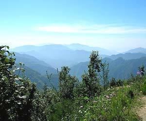
Kanatal has an average elevation of about 8500 feet (2590 meters). The highest point is Surkunda Devi Temple, at a height of about 9,995 feet. There is scarcity of water; temperature in winters go freezing. The roads are blocked with snow — often crystallized and hard enough to skid vehicles thousands of meters down the valley.
Accessibility
Kanatal is conveniently connected by road to Delhi and major cities. The closest railway station and airport is Dehradun. Taxis are easily available for Kanatal.