
- summer (DST) CDT (UTC-5) Population 326 (2013) Area code 618 | Local time Saturday 8:50 AM Postal code 62053 | |
 | ||
Weather 3°C, Wind NW at 21 km/h, 70% Humidity Area 3.212 km² (2.642 km² Land / 57 ha Water) | ||
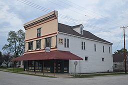
Kampsville is a village in Calhoun County, Illinois, United States, located on the west bank of the Illinois River. The population was 328 at the 2010 census, an increase from 302 in 2000.
Contents
Map of Kampsville, IL 62053, USA
Name
Kampsville was originally known as Beeman's Landing, after James L. Beeman, a ferry operator on the Illinois River. After Stephen Farrow (1802–1856) purchased the ferry from Beeman, the name was changed to Farrowtown. The name Vedder was used when the post office was established in 1857. The name Kampsville was made official on 6 March 1872 and refers to Michael A. Kamp (1829–1922), who served as president of the village board and was also a postmaster at Silver Creek, north of Kampsville.
General information
The Kampsville ferry crosses the Illinois River and connects the Kampsville segment of Illinois Route 108 with its remainder in Greene County. The ferry is free and runs 24 hours a day, seven days a week. It is one of two permanent ferries operated by the Illinois Department of Transportation.
The village is the base of operations for the Center for American Archeology, an educational and research organization dedicated to the archeological understanding of the Native Americans and of the European settlers in the region. It contains exhibits demonstrating evidence of 7,000 years of human habitation excavated at the Koster Site in nearby Greene County.
Geography
According to the 2010 census, Kampsville has a total area of 1.24 square miles (3.21 km2), of which 1.02 square miles (2.64 km2) (or 82.26%) is land and 0.22 square miles (0.57 km2) (or 17.74%) is water.
Demographics
As of the census of 2000, there were 302 people, 133 households, and 82 families residing in the village. The population density was 296.2 people per square mile (114.3/km²). There were 161 housing units at an average density of 157.9 per square mile (60.9/km²). The racial makeup of the village was 95.70% White, 0.33% Native American, 0.99% Asian, 1.99% from other races, and 0.99% from two or more races. Hispanic or Latino of any race were 0.66% of the population.
There were 133 households out of which 26.3% had children under the age of 18 living with them, 46.6% were married couples living together, 11.3% had a female householder with no husband present, and 38.3% were non-families. 33.1% of all households were made up of individuals and 18.8% had someone living alone who was 65 years of age or older. The average household size was 2.27 and the average family size was 2.93.
In the village, the population was spread out with 24.2% under the age of 18, 7.9% from 18 to 24, 25.5% from 25 to 44, 19.9% from 45 to 64, and 22.5% who were 65 years of age or older. The median age was 40 years. For every 100 females there were 93.6 males. For every 100 females age 18 and over, there were 89.3 males.
The median income for a household in the village was $26,875, and the median income for a family was $28,750. Males had a median income of $34,250 versus $17,500 for females. The per capita income for the village was $13,158. About 22.6% of families and 24.5% of the population were below the poverty line, including 38.6% of those under the age of eighteen and 20.7% of those sixty five or over.