
Country Thailand Postal code 73140 Area 405 km² Province Nakhon Pathom Province | Time zone ICT (UTC+7) Geocode 7302 Population 127,817 (2015) | |
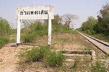 | ||
Kamphaeng Saen (Thai: กำแพงแสน; [kām.pʰɛ̄ːŋ sɛ̌ːn]) is the northwesternmost district (amphoe) of Nakhon Pathom Province, central Thailand.
Contents
Map of Kamphaeng Saen District, Nakhon Pathom, Thailand
History
Kamphaeng Saen was a moated center of Dvaravati culture, dating from 410-870 CE, with the foundation of a Buddhist stupa identified.
Geography
Neighboring districts are (from the north clockwise) Song Phi Nong of Suphanburi Province, Bang Len, Don Tum and Mueang Nakhon Pathom of Nakhon Pathom Province, Ban Pong of Ratchaburi Province, and Tha Maka of Kanchanaburi Province.
Kasetsart University's Kamphaeng Saen campus is in this district.
Administration
The district is divided into 15 subdistricts (tambon), which are further subdivided into 202 villages (muban). Kamphaeng Saen is also a township (thesaban tambon), which covers parts of the tambon Kamphaeng Saen and Thung Kraphang Hom.