
Country Japan Prefecture Nara Prefecture Population 707 (1 Mar 2010) District Yoshino District, Nara | Region Kansai Area 274 km² Local time Saturday 8:38 PM | |
 | ||
Time zone Japan Standard Time (UTC+9) City hall address 330 Kawai, Kamikitayama-mura, Nara-ken
639-3701 Website vill.kamikitayama.nara.jp Weather 5°C, Wind W at 11 km/h, 55% Humidity Points of interest Mount Ōdaigahara, Mt Hachigyogatake, Kodokoro Hot Spring, Nakano Falls, Keitokuji | ||
Kamikitayama (上北山村, Kamikitayama-mura) is a village located in Yoshino District, Nara Prefecture, Japan.
Contents
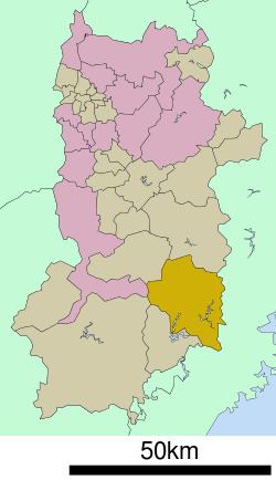
- Map of Kamikitayama Yoshino District Nara Prefecture Japan
- Neighboring municipalities
- Education
- Notable places
- References
Map of Kamikitayama, Yoshino District, Nara Prefecture, Japan
As of August 6, 2012, the village has an estimated population of between 500 and 600. The total area is 274.05 km2.
The village has an aging population. Between 2002 and 2007 the population declined by 15.6%. This trend has continued.
Neighboring municipalities
Education
As of 2012 the two schools have a combined student population of 27. Even with such a small student body, in 2009 the village began employing an ALT(Assistant Language Teacher) of English from the JET Programme to live and work in village.
Notable places
References
Kamikitayama, Nara Wikipedia(Text) CC BY-SA