
Last eruption 1769 Prominence 1,970 m Listing Ultra-prominent peak | Elevation 2,156 m | |
 | ||
Similar Ilyinsky, Gamchen, Ksudach, Khodutka, Diky Greben | ||
Kambalny (Russian: Камбальный) is a stratovolcano located in the southern part of Kamchatka Peninsula, Russia. It is the southernmost active volcano of Kamchatka. It has erupted mafic rocks. It has a summit crater as well as five cinder cones on its flanks which are the source of lava flows.
Contents
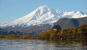
Map of Kambalny, Kamchatka Krai, Russia, 684111
The volcano probably formed during the early Holocene. Three large collapses of the edifice occurred around 6300 BP; between the first two volcanic activity restored the cone, while the third occurred on the ridge on which Kambalny was constructed. The longest of these landslides travelled 20 kilometres (12 mi). The total volume of these landslides, 5–10 cubic kilometres (1.2–2.4 cu mi), is the largest of all Holocene landslides, but it was buried at Kambalny proper by later volcanic activity. The collapse scar in the ridge is still visible and was the site of later landslides when Kambalny volcano was active.
Kambalny is part of a group of volcanoes from the late Pleistocene and the Holocene that surround the Kurile Lake caldera. Other volcanoes in that group are Diky Greben, Ilyinsky, Koshelev and Zheltovsky. Kambalny itself is constructed on a ridge which formed in the Quaternary during the uplift of the central part of a trough. This trough is also the site of the Pleistocene Pauzhetka Caldera and Kambalny formed on this caldera rim. The position of Kambalny is also controlled by the margin between the Kurile island arc and the South Kamchatka block.
The cone rises about 1,800 metres (5,900 ft) above the surrounding terrain. The Pauzhetsky geothermal field is associated with the Kambalny volcanic ridge, and Kambalny may be the heat source for this system. The geothermal energy output at Kambalny is about 320 megawatts (320,000,000 W). Fumarolic activity along with the emission of CO
2, H
2S and CH
4 occur in the area of Kambalny.
Recent eruption history
The last eruption from Kambalny occurred 1769. Future volcanic activity from the volcano may be a threat to the Mutnovsky geothermal operations. Further, additional large collapses of the edifice are possible, which may endanger hunters, fishermen and tourists. As of June 2012, the volcano has no associated seismic station.
The ash erupted during a phreatic eruption 564–686 years BP is a marker ash that has been found as far as Paramushir island in the northern portion of the Kuril Islands. Tephras younger than this date have been identified as well.