
Local time Saturday 11:12 AM | Number of airports 1 | |
 | ||
Weather 13°C, Wind N at 16 km/h, 44% Humidity Points of interest Santorini caldera, Nea Kameni, KAMARI BEACH | ||
Kamari beach santorini 2015
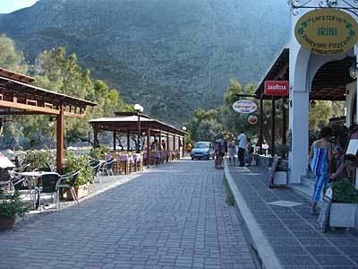
Kamari (Greek: Καμάρι) is a coastal village on the southeastern part of the Aegean island of Santorini, Greece, in the Cyclades archipelago with a population of approx. 1800 according to the 2001 census. It is part of the Municipality of Thira and is situated approximately 8 km away from the island's capital Fira. Kamari was built by residents of the nearby village of Episkopi Gonias, which was almost flattened by a devastating earthquake that hit Santorini in July 1956.
Contents
- Kamari beach santorini 2015
- Map of Kamari 847 00 Greece
- Nissia apartments kamari santorini island greece
- References
Map of Kamari 847 00, Greece
The village got its name from a small arch (Greek: Καμάρα, Kamara) that still rises at the south end of its beach and is what remains from an ancient sanctuary dedicated to Poseidon. Today, it stretches along a beach covered with black pebbles, which is the longest of the island. The beach extends in a northeast to southwest direction from Monolithos to the feet of the Mesa vouno mountain that rises up to a height of approx. 400m, being Santorini's second highest peak. Once an agricultural and fishing village, modern Kamari boasts a thriving tourist industry, offering a wide choice of accommodation, restaurants, cafes, bars and night clubs, plus several water sport activities.
In 2002, an archaic sanctuary dedicated to Achilles was discovered in Kamari.