
Country Belgium Postal code 2920 | Province Antwerp Postal codes 2920 Local time Saturday 7:08 AM | |
 | ||
Weather 10°C, Wind W at 31 km/h, 93% Humidity Points of interest Arboretum Kalmthout, Bijenteeltmuseum, Provinciaal Suske en Wiske‑Kindermu, NEC De Vroente | ||
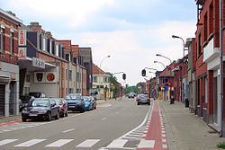
Kalmthout ( [ˈkɑlmtɦʌu̯t]) is a municipality in the Belgian province of Antwerp. The municipality comprises the villages of Kalmthout, Achterbroek and Nieuwmoer. On January 1, 2007 Kalmthout had a population of 17,508. The total area is 59.45 square kilometres (22.95 sq mi). Kalmthout has a population density of 294 inhabitants per km².
Contents
Map of 2920 Kalmthout, Belgium
In addition to Kalmthout itself, the municipality also contains the communities of Dorp-Heuvel, Heide, Achterbroek, and Nieuwmoer.
The Arboretum Kalmthout is one of Belgium's most beautiful botanical gardens. The Kalmthoutse Heide is a nature reserve of nearly 10,000 acres (40 km2) spanning the border between Belgium and the Netherlands.
Notable inhabitants
References
Kalmthout Wikipedia(Text) CC BY-SA