
Population 18,982 (2011 census) Postal code 4503 Lga Moreton Bay Region | Postcode(s) 4503 Local time Saturday 3:03 PM | |
 | ||
Weather 32°C, Wind N at 11 km/h, 51% Humidity | ||
Kallangur is a suburb in Moreton Bay Region, Queensland, Australia. It is north of Brisbane, the state capital. At the 2011 Australian Census the suburb recorded a population of 18,982. A section of the Bruce Highway marks the eastern boundary.
Contents
- Map of Kallangur QLD 4503 Australia
- History
- Demographics
- Transport
- Kallangur bypass
- Education
- Kallangur song
- Heritage listings
- References
Map of Kallangur QLD 4503, Australia
History
The area once belonged to Mrs. Griffin of Whiteside, west of Petrie, and was acquired by a Scottish migrant by the name of Thomas Petrie in 1855. The name Kallangur originates from the Aboriginal word kalangoor, meaning a goodly or satisfactory place.
Gympie Road (now Old Gympie Road) passed through Kallangur from Brisbane to Gympie. It was a route travelled by Cobb & Co coaches.
Kallangur grew in the early twentieth century as it was on the main road route to the Redcliffe peninsula before the construction of the Hornibrook Bridge in the 1930s. More recent development has been in response to the general housing demand in the northern growth corridor. The main thoroughfare in Kallangur is route 71, Anzac Avenue.
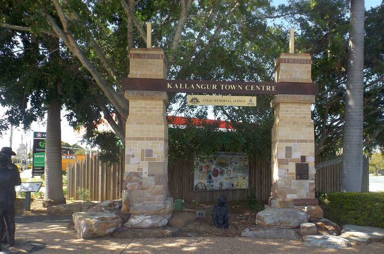
An ANZAC memorial gate was erected along with a bronze statue on the corner of Anzac Avenue and Goodfellows Road. The new Memorial Gardens was unveiled in front of the North's Leagues and Services Club in 2005 by the former Minister for Veterans' Affairs De-Anne Kelly.
Demographics
In the 2011 census, Kallangur recorded a population of 18,982 people, 51.1% female and 48.9% male. The median age of the Kallangur population was 33 years, 4 years below the national median of 37. 77.9% of people living in Kallangur were born in Australia. The other top responses for country of birth were New Zealand 5.9%, England 4%, Philippines 0.7%, South Africa 0.7%, Scotland 0.5%. 90.9% of people spoke only English at home; the next most common languages were 0.6% Samoan, 0.4% Hindi, 0.4% Spanish, 0.3% Tagalog, 0.3% German.
Transport
Kallangur railway station was completed in 2016.
Kallangur bypass
The Kallangur Bypass, also referred to as the Petrie to Mango Hill transport corridor, is a proposed infrastructure project to alleviate traffic congestion in this area. The preserved transport corridor lies adjacent to the western section of the Redcliffe Peninsula railway line. The infrastructure project is a road between Petrie and Mango Hill, and is pending Queensland Transport decisions and funding.
Education
Kallangur song
Although not an official song, the musical act, Jaded Cadence, has released a song about living in Kallangur, including a verse about the Bruce Highway, Redcliffe, Maroochy, and Cavill Avenue.
Heritage listings
Kallangur has a number of heritage-listed sites, including: