
Official name Kallanai Dam Impounds Cauvery Length 329 m | Location Trichy District Width (base) 20 m (66 ft) | |
 | ||
Type of dam Composite Dam and Reservoir Similar Upper Anaicut, Ucchi Pillayar Temple, Vekkali Amman Temple, Jambukeswarar Temple - Thiruvanaikaval, Ranganathaswamy Temple - Srirangam | ||
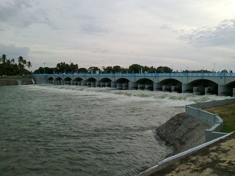
Picturesque grand anicut kallanai dam hd
Kallanai (also known as the Grand Anicut , Tamil : கல்லணை) is an ancient dam, which is built (in running water) across the Kaveri river in Tiruchirapalli District in the state of Tamil Nadu in South India. Located at a distance of 15 km from Tiruchirapalli, the dam was originally constructed by the Chola king Karikalan in 2nd century AD. It is located on Kaveri river approximately 20 KM from Trichy, but the dam falls under Thanjavur district . and is the fourth-oldest water-diversion or water-regulator structures in the world which is still in use.
Contents
- Picturesque grand anicut kallanai dam hd
- Map of Kallanai Tamil Nadu 620013
- Kallanai dam drive 360 virtual reality vr video in trichy tamilnadu india famous historical dams
- History
- Geography
- Description
- References
Map of Kallanai, Tamil Nadu 620013
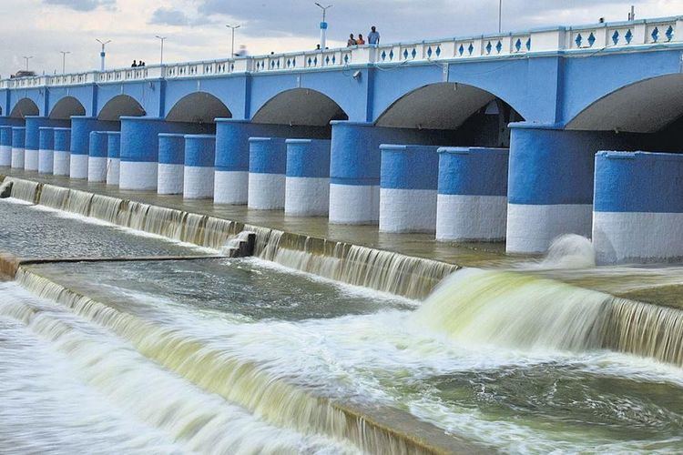
Kallanai dam drive 360 virtual reality vr video in trichy tamilnadu india famous historical dams
History
The dam was originally built by Karikalan about 2000 years ago.The idea behind the construction of the dam was to divert the river to the delta districts thereby boosting irrigation. The dam was re-modeled by the British during the 19th century. In 1804, Captain Caldwell, a military engineer, was appointed by the British to make a study on the Kaveri river and promote irrigation for the delta region. He found that a large amount of water passed onto the Kollidam leaving behind a small volume for irrigation purposes. Caldwell initially proposed a solution by raising the dam and hence raised the dam stones to a height of 69 centimetres (27 in), thus increasing the capacity of the dam. Following this, Major Sim proposed the idea of undersluices across the river with outlets leading to the Kollidam River (Coleroon) thus preventing formation of silt. The Lower Anaicut built by Sir Arthur Cotton in 19th century CE across Coleroon, the major tributary of Cauvery, is said to be a replicated structure of Kallanai.
Geography
The Kaveri river splits into two at a point 20 miles (32 km) west of Kallanai. The two rivers form the island of Srirangam before joining at Kallanai. The northern channel is called the Kollidam (Coleroon); the other retains the name Kaveri, and empties into the Bay of Bengal at Poompuhar. On the seaward face of its delta are the seaports of Nagapattinam and Karaikal.
Description
The purpose of the Kallanai was to divert the waters of the Kaveri across the fertile delta region for irrigation via canals. The dam splits the river Kaveri into 4 streams known as Kollidam Aru, Kaviri, Vennaru and Puthu Aru. It is constructed from unhewn stone spanning the Kaviri and is 329 m (1,079 ft) long, 20 m (66 ft) wide and 5.4 m (18 ft) high. The dam is still in excellent condition, and supplied a model to later engineers, including Sir Arthur Cotton's 19th-century dam across the Kollidam, the major tributary of the Kaveri. The area irrigated by the ancient irrigation network is about 69,000 acres (28,000 ha). By the early 20th century, the irrigated area had been increased to about one million acres (400,000 ha).
The Delta farmers of Tamil Nadu have demanded that the Tamil Nadu government honour Karikala Cholan, who built the Kallanai.